Why Everest Base Camp, despite everything, is still the one everyone wants
Nepal has quieter trails. Cheaper ones, too. Manaslu has fewer people on it. Annapurna has arguably gentler terrain. And yet Everest Base Camp remains the trek every serious hiker circles first, the one people mention when they say "before I turn 40" or "before my knees give out." That pull isn't an accident, and it isn't just marketing. It's earned.
Some of it is history. In May 1953, Edmund Hillary and Tenzing Norgay became the first climbers confirmed to reach the summit, and the base camp you'll walk to is the same staging ground expeditions have used ever since, the last flat-ish patch of glacier before the real mountain begins. You're not just visiting a viewpoint. You're standing where over a century of mountaineering ambition has assembled, roped up, and set off.
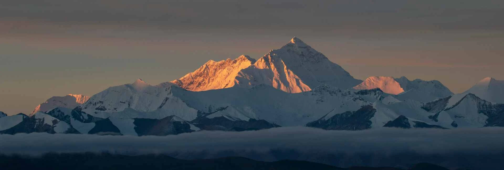
Some of it is the mountain itself. To Tibetans it's Chomolungma, generally rendered as "Goddess Mother of the World." To Nepalis it's Sagarmatha, "Forehead of the Sky" or "Peak of Heaven," a name adopted in the 1960s to give the mountain a Nepali identity of its own. Both names carry the same idea: this isn't just the tallest point on Earth, it's treated as something closer to sacred by the people who have lived in its shadow for generations. You'll feel that at Tengboche monastery, at the prayer flags strung across every ridge, in the way your guide talks about the mountain differently than a tourist brochure does.
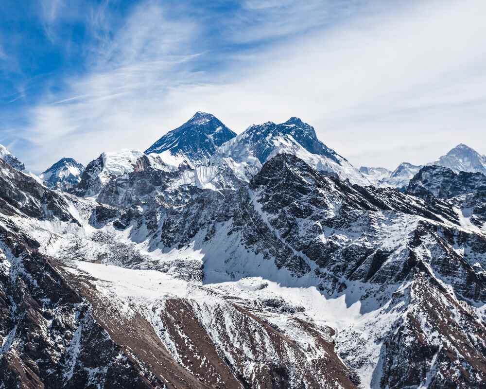
And some of it is simply density. Nowhere else on the planet do you walk for two weeks with this many 8,000-meter giants in view: Everest, Lhotse, Makalu, Cho Oyu all visible from points along this one trail. Crowded, yes. Expensive relative to other Nepal treks, also yes. But there's a reason the crowds keep coming, and it's not just Instagram.
This guide covers everything you need to plan the trek properly: what it actually costs, how hard it really is, what each stage of the trail looks like, and where to go for the deeper detail on permits, budget, and altitude sickness. Consider this the map of the whole trip; the standalone posts linked throughout are where you go once you're ready to plan the specifics.
Quick Trek Overview
| Duration | 12–16 days (Lukla to Lukla), most itineraries run 14 days |
| Distance | Roughly 130 km (80 miles) round trip |
| Max altitude | 5,545 m / 18,192 ft (Kala Patthar); Base Camp itself sits at 5,364 m / 17,598 ft |
| Permits required | Sagarmatha National Park Entry Permit + Khumbu Pasang Lhamu Rural Municipality Permit |
| Guide requirement | Effectively mandatory in practice, though the Khumbu's exact legal status has been a genuine gray area (see the permits section below) |
| Best seasons | Spring (March–May) and autumn (late September–November) |
For the full walkthrough with a day-by-day breakdown, see the Everest Base Camp trek itinerary. We're not duplicating that table here; the version there is kept current and is the one to actually plan against.
Difficulty: what makes it hard, what makes it manageable
Here's the thing competitor content tends to get wrong: it either scares people off by making EBC sound like a technical mountaineering feat, all crevasse rescue and ice axes, or it undersells it as "just walking" because there's no roped climbing involved. Neither is honest, and the truth sits in an uncomfortable middle ground that's worth spelling out plainly.
What makes it hard: almost entirely the altitude, and almost none of it the terrain. You're not scrambling up exposed rock or picking your way across crevasses on a rope team. You're walking on well-established trails, stone staircases worn smooth by generations of yak trains and porters, switchbacks that a reasonably fit person could climb without much trouble on a good day at sea level. The problem is you're not at sea level. By Namche Bazaar you're already above 3,400 m, breathing air that's noticeably thinner even if you can't quite articulate why your legs feel heavier than the grade should warrant, and you keep climbing from there. Above roughly 2,500 m, the air holds meaningfully less oxygen than your body is used to, and it only gets thinner as you go, until a short uphill stretch near Gorak Shep leaves you pausing every twenty steps to catch your breath. Altitude sickness doesn't care how many marathons you've run; it's a function of pace and acclimatization, not fitness, and it can flatten a strong athlete just as easily as a first-time trekker. This is the single most important thing to understand before you book: your training plan matters less than your itinerary's rest days.
What makes it manageable: the terrain itself, which is genuinely forgiving by high-altitude trekking standards. There's no technical climbing, no ropes, no crampons for the standard EBC route (that's a different trip if you're adding Island Peak or a pass crossing). The trail is well-marked and well-trodden, wide enough in most stretches to walk two abreast, and dotted with teahouses roughly every few hours, so you're never far from a hot meal, a warm stove to dry your socks by, or another trekker to flag down if something's wrong. Daily walking days are typically 4 to 7 hours, which is demanding on tired legs but not brutal, and the schedule builds in dedicated acclimatization days at Namche and Dingboche for exactly this reason, giving your body time to catch up with the elevation before you ask it to go higher.
The honest summary: if you're moderately fit, you can walk this trail. Whether you can walk it without getting sick depends almost entirely on how well you respect the altitude: go slow, drink more water than feels necessary, and don't skip the rest days even when you feel unstoppable and full of energy on day three. More on that in the altitude sickness section below.
The trail, village by village
The trek breaks into five distinct stretches, and each one has its own character, its own altitude challenges, and its own reasons to slow down and look around rather than just put your head down and walk. Knowing what's coming at each stage changes how you plan around it: which days to take slowly, which acclimatization stop to actually use as a rest day instead of a side-quest, and which stretch to save your energy for. What follows is the fuller version of each; the standalone posts linked at the end of each section go deeper still, into where to eat, where to sleep, and what to actually do with your acclimatization days.
Lukla to Namche Bazaar.
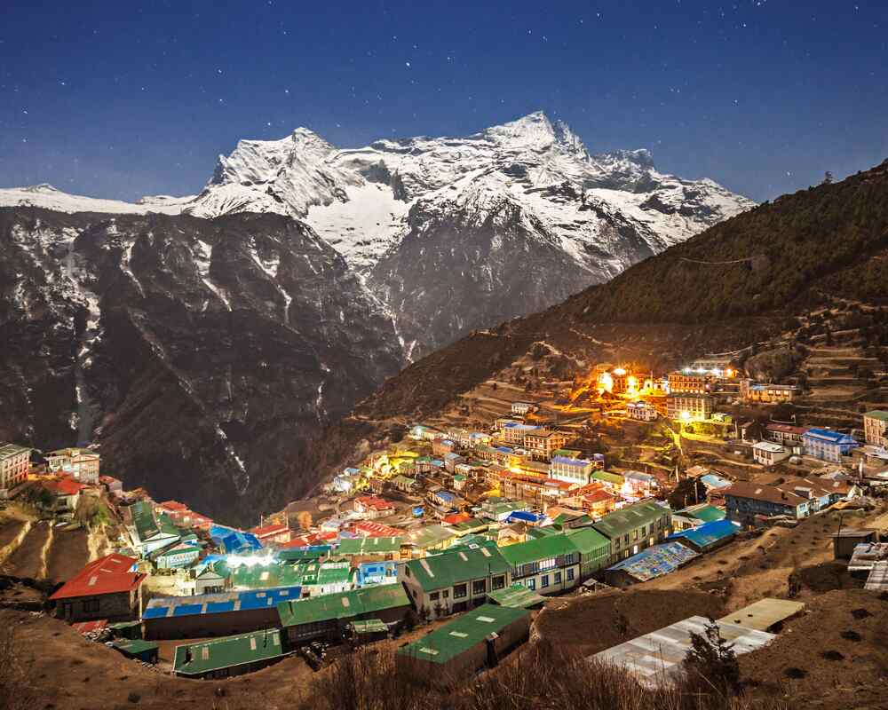
This is where the trek actually begins, after the short, famously hair-raising flight into Tenzing-Hillary Airport, a runway that slopes uphill into a mountainside and ends in a stone wall, one of the more memorable ten minutes of any trip to Nepal. From Lukla, the trail drops down into the Dudh Kosi valley and follows the river for the better part of two days, through Sherpa villages like Phakding and Monjo, past prayer wheels spinning in the current, mule and yak trains loaded with supplies for the villages higher up, and swinging suspension bridges strung with tattered prayer flags, the river itself a startling glacial turquoise far below. This stretch is deceptively easy on the legs, mostly flat or gently rolling, which is exactly why people underestimate what's coming. Your first real climb is saved for the final push into Namche Bazaar: a steep, switchbacking ascent through pine forest that gains over 600 m in a single day and tends to be where the altitude first makes itself known, usually as heavier breathing and a slower pace rather than anything alarming. Namche itself is the unofficial capital of the Khumbu, a bowl-shaped town built into the hillside like an amphitheater, its narrow lanes lined with bakeries, gear shops, and buzzing teahouses that feel almost like a small mountain city after two days of quiet trail. It's also your first mandatory acclimatization stop, which typically means a full extra day here, often used for a short hike up to the Everest View Hotel or the Namche museum rather than genuine rest.
That short, hair-raising flight is its own story, and worth reading on its own before you book: what the Lukla flight actually involves, why delays happen, and how to plan around them, is covered in full in Lukla: The Flight That Starts Every EBC Trek. Namche itself deserves more than a passing mention too. Our guide Ang Tendi Sherpa, who grew up in the valley, has written a first-person piece on Namche Bazaar as the historic Sherpa trading capital, covering its origins on the old Tibet-Kathmandu salt route, the Saturday market, the Sherpa Culture Museum, and exactly why that acclimatization day there isn't optional.
Namche Bazar to Tengboche
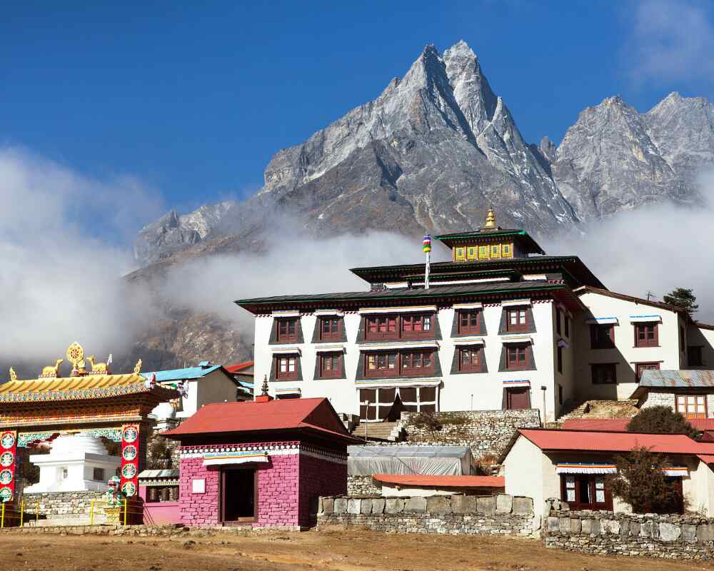
A shorter, gentler-looking stretch on paper that still catches people off guard, because it involves a steep drop down to the river at Phunki Thanga followed by an equally steep climb back up to Tengboche; at altitude, that kind of up-and-down costs more than the map suggests, and legs that felt fine in Namche can feel surprisingly heavy by the top. The trail runs through rhododendron and birch forest thick with the smell of pine needles and, in spring, scattered with fallen blossoms underfoot, opening every so often onto a clearing with a sudden, jaw-dropping view of Ama Dablam's distinctive fishtail peak. The payoff is Tengboche monastery itself, the spiritual heart of the Khumbu, set on a grassy plateau with Everest and Ama Dablam framing it on either side. Time your arrival right and you'll catch the evening puja, monks chanting inside while the light goes gold on the peaks outside, and on a clear morning this is one of the best viewpoints on the entire route, before the cloud cover typically rolls in by midday. If you're curious about the monastery's history and origins, this piece on the history of Tengboche Monastery is worth a read before you arrive.
Tengboche to Dingboche.
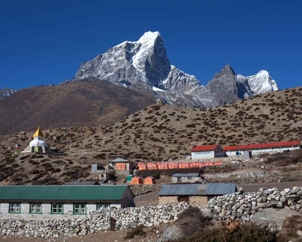
The trees disappear here, almost abruptly, and the whole feel of the trek shifts with them. You're now walking through high alpine terrain, scrubby juniper and bare rock replacing forest, the landscape opening into wide glacial valleys with the Himalayan giants closing in on both sides, close enough that they start to feel less like a backdrop and more like company you're walking alongside. The trail passes through Pangboche, home to one of the oldest monasteries in the Khumbu, before the valley splits and the EBC route bears toward Dingboche rather than the Gokyo side valley. Dingboche is your second mandatory acclimatization stop, a patchwork of stone-walled potato and barley fields and low, weathered lodges built to withstand wind that can be relentless here even on a clear day. Some itineraries route through nearby Pheriche instead, and the two aren't interchangeable; our comparison of Dingboche versus Pheriche as an acclimatization stop breaks down which one actually suits your itinerary better. Most itineraries use the rest day for a side hike up Nangkartshang Peak, both for the views back down the valley and for the altitude adaptation, since gaining elevation during the day and sleeping lower is one of the most effective ways to acclimatize.
Dingboche to Lobuche.
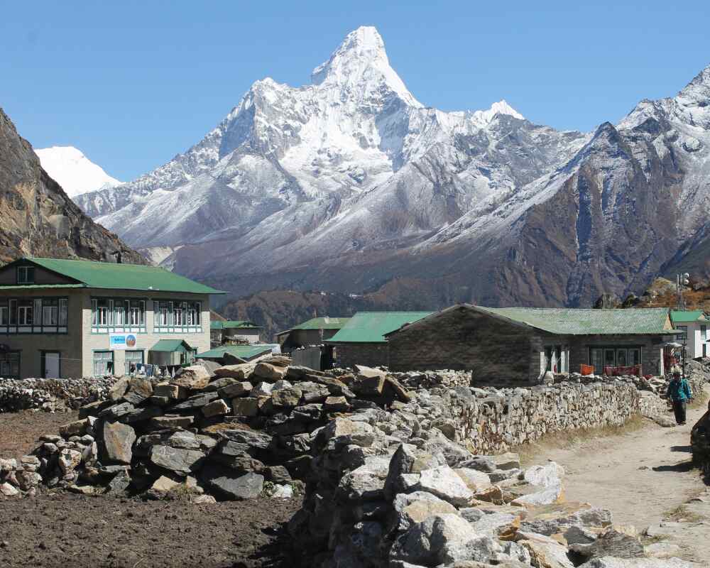
This stretch is where the trek starts to feel genuinely remote, and genuinely quiet. Thinner air, sparser vegetation giving way to bare scree and glacial moraine, and a long, steady climb up to Thukla before the trail levels out along a ridge with sweeping views back down the valley. It's at the top of that climb that you reach the Everest memorials, a windswept hillside crowded with stone chortens and prayer flags built for climbers, including some very well-known names in mountaineering history, who didn't come home. It's a sobering, quiet stop that most trekkers don't expect and remember longer than almost anything else on the route, the wind carrying the sound of flags snapping and little else. Lobuche itself is small and basic, a handful of lodges clustered together, more a waypoint than a destination, and most people treat it as exactly that: a short, low-key night before the final push.
Lobuche to Gorak Shep, Base Camp, and Kala Patthar.
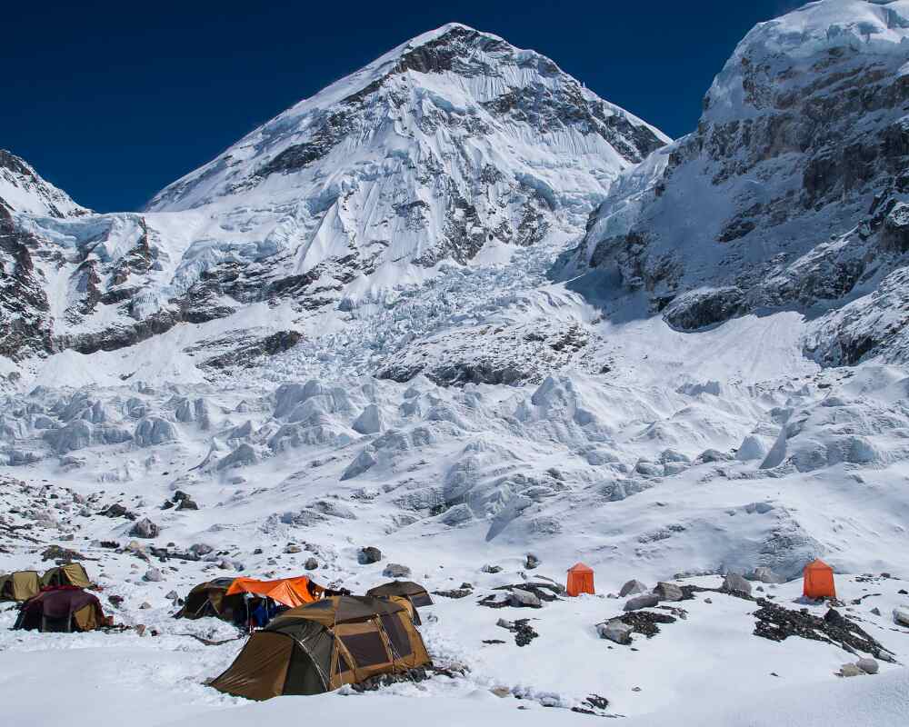
The final stretch, and the one people picture when they picture the trek at all. The walk from Lobuche follows the edge of the Khumbu Glacier's lateral moraine, a rough, undulating trail with Pumori looming overhead, before dropping onto Gorak Shep: the last settlement before Base Camp itself, a frozen former lakebed turned final teahouse outpost, gray and windswept and utterly unlike anywhere else on the route. Most itineraries drop packs at Gorak Shep and continue on to Base Camp the same afternoon, a rocky, glacier-adjacent walk across the Khumbu Glacier's moraine, weaving between boulders and past small meltwater ponds with the Khumbu Icefall's tumbled, blue-white seracs looming overhead. Base Camp itself, in trekking season, is a scatter of colorful expedition tents rather than a single dramatic viewpoint, and worth knowing that going in so it doesn't undersell the moment. This full Kala Patthar Everest viewpoint guide covers exactly what to expect on this final push, from Gorak Shep through to the pre-dawn climb.The real payoff view usually comes the next morning, well before dawn, on the steep climb up Kala Patthar: the best unobstructed view of Everest's summit anywhere on the trek, first light hitting the peak while everything below is still in shadow and the cold is sharp enough to feel in your teeth.
Permits: what you actually need
Two permits, not the old TIMS card system that some outdated guides still reference: TIMS has been phased out for the Khumbu region and replaced by the local municipality permit below.
| Permit | Cost (foreign trekkers) | Where to get it |
|---|---|---|
| Sagarmatha National Park Entry Permit | NPR 3,000 (~US$23) | Nepal Tourism Board office in Kathmandu, or the park checkpoint at Monjo |
| Khumbu Pasang Lhamu Rural Municipality Permit | NPR 3,000 (~US$23) | Same locations as above, or at Lukla |
| Total | ~NPR 6,000 (~US$45) |
SAARC nationals pay a reduced rate on the national park permit (roughly NPR 1,500); Nepali citizens pay a nominal fee. These figures are current as of publication but permit fees do move; confirm the live rate with the Nepal Tourism Board or your agency before you fly out.
On the guide question specifically: since 2023, Nepal has required a licensed guide for foreign trekkers in most national parks and conservation areas nationwide. The Khumbu has been a genuine exception to watch: the Khumbu Pasang Lhamu Rural Municipality has at various points issued its own notices affirming that solo trekking remains legal in this specific region, running its own entry system independent of the national mandate. In practical terms: don't plan around this ambiguity. A guide dramatically improves your safety margin at altitude regardless of what's legally required in a given month, and if you're booking through an agency it's included anyway. If you're determined to go independently, verify the current rule directly with the municipality or Nepal Tourism Board before you travel; this is one of the few details in Nepal trekking regulation that has genuinely shifted year to year.
Best time to trek
Spring (March–May) and autumn (late September–November) are the two windows almost every guide, including your own, will point you toward, and for good reason. Both seasons bring stable weather patterns, warmer daytime temperatures on the trail, and the clearest possible mountain views, which matters more on this trek than most, given how much of the appeal is the view itself. Spring adds rhododendron forests blooming pink and crimson along the lower trail below Namche, plus slightly milder nights higher up as the season warms toward summer. Autumn tends to edge it out for pure visibility: the monsoon rains have just cleared the dust and haze out of the air, skies run crisp and consistently blue, and it's the busier of the two seasons on the trail as a result, since word has gotten around.
The two windows aren't identical, though, and the differences matter for planning. Spring can bring more afternoon cloud buildup as the weather warms; autumn can bring colder overnight temperatures earlier in the season than people expect, especially above Dingboche. Outside those two windows, winter (December–February) offers genuinely clear skies and near-empty trails, at the cost of serious cold, especially overnight, and a higher chance of teahouses in the upper villages closing for the season. Monsoon (June–August) is generally avoided for EBC specifically, since low cloud cover routinely erases the mountain views that are most of the point, on top of leech-heavy lower trails and a higher risk of Lukla flight delays.
We've written a full breakdown of how the seasons actually differ on the trekking route, including detailed monsoon and winter trade-offs for trekkers who can't hit the peak windows: see our best time to trek in Nepal guide for the full comparison.
Altitude sickness: the real risk on this trek
f there's one section of this guide worth reading twice, it's this one. As covered above, altitude, not terrain, is what makes EBC genuinely difficult, and Acute Mountain Sickness, that dull creeping headache, the loss of appetite, the nights of restless half-sleep, is the reason most trekkers who don't finish, don't finish. It isn't rare or exotic; some degree of mild AMS is common above 3,500 m even on a well-paced itinerary, and the goal isn't to avoid it entirely so much as to catch it early and respond correctly, rather than push through it and hope it passes on its own.
The good news is that AMS is largely predictable and largely preventable with the right pacing. The core rule guides use is "climb high, sleep low": gain elevation during the day, but let your sleeping altitude rise more gradually than your daytime high point, which is exactly why the itineraries built around Namche and Dingboche rest days exist, and why those side hikes to higher viewpoints on rest days aren't just bonus scenery, they're doing real acclimatization work. Hydration, a slow and steady pace rather than a fast one, and being honest with your guide about symptoms rather than pushing through them are the other pillars of prevention, and all three matter more than most people expect going in.
We've put the full detail (specific symptoms, what's normal versus what's a genuine turn-around sign, medication like Diamox, and how to actually structure your days to acclimatize properly) in its own dedicated guide: High Altitude Sickness: What Every Trekker Needs to Know.
Cost breakdown
Real numbers, not marketing ranges. What you pay depends heavily on trekking style:
| Style | Typical total cost | What's included |
|---|---|---|
| Budget / independent | $1,000–$1,400 | Basic teahouses, shared meals, permits, minimal guide/porter services |
| Standard guided package | $1,300–$2,000 | Full-board teahouse lodging, licensed guide, porter, permits, Lukla flights |
| Premium | $2,000–$3,000 | Better lodges, more experienced guides, more comfort throughout |
| Luxury (helicopter return, premium lodges) | $3,500–$6,000+ | Private guide, upgraded accommodation start to finish, helicopter option from Gorak Shep |
The single biggest swing factor across every tier is the Lukla flight: prices and availability shift with the season, and delays or Ramechhap diversions can add unplanned cost. Guide and porter tipping, gear rental, and personal spending (hot showers, wifi, snacks) are the other line items people consistently underbudget for.
This table is the summary. For the full line-item breakdown, exactly what a budget versus standard versus luxury trek costs at every stage of the trail, see our dedicated Everest Base Camp Trek Cost 2026–2027 guide. If you're deciding between trekking styles rather than just budgeting for one, our budget EBC trek and luxury EBC trek pages lay out what each tier actually looks like on the ground.
FAQ
Do I need previous trekking experience for EBC?
No technical climbing experience is required, and you don't need to have done a major trek before. What matters more is cardiovascular fitness and, more than that, patience with the acclimatization schedule; the trail itself doesn't require special skills.
How fit do I need to be?
You should be comfortable walking 4–7 hours a day, several days in a row, with a daypack. Regular hiking, running, or stair training in the months before you go will help more than any single intense workout right before departure.
Can I trek to EBC without a guide?
Legally, this has been a genuinely unsettled question specific to the Khumbu region (see the permits section above). Practically, we'd recommend against it regardless of the legal answer in any given month: altitude-related emergencies are exactly the situation where a licensed guide's judgment and local relationships matter most.
What's the success rate for reaching Base Camp?
Most trekkers who train reasonably and follow their itinerary's acclimatization schedule do reach Base Camp. The trekkers who turn back are almost always doing so because of altitude symptoms, not fitness failure, which is the whole argument for not rushing the schedule.
Is EBC crowded?
Yes, particularly in peak spring and autumn weeks; this is the most popular trek in Nepal. Teahouses can fill up in high season, which is part of why booking ahead and going with an agency that has lodging relationships along the route matters.
Do I need travel insurance?
Yes, and specifically insurance that covers high-altitude trekking and helicopter evacuation above 5,000 m; standard travel insurance frequently excludes this, and it's the one gap that turns a manageable emergency into a genuinely dangerous one.
If you've been circling this trek, take that as a sign
Most people who end up standing at Everest Base Camp spent a long time thinking about it first: reading guides, watching videos, telling themselves next year. There's nothing wrong with being thorough. But if you've made it this far into a guide this detailed, you're not casually curious anymore. You're planning.The mountain isn't going anywhere, and neither is the trail. What changes year to year is your knees, your schedule, and how much longer "someday" stays realistic. If EBC has had your attention for a while now, that's usually the tell that it's time to actually book the dates.
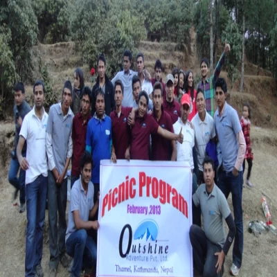
And a successful trek almost always comes down to who's leading it. An expert guide isn't a nice-to-have on this route, it's what turns a hard trek into a manageable one. That's exactly what you get with Outshine Adventure: guides like Som Majhi, Prakash Nagarkoti, and Bheg Bahadur Gurung, who carry out the Everest trek at least five to six times a year, know the trail, the villages, and the pace it demands better than a brochure ever could.
If EBC has been on your list, this is the sign to stop planning in theory and start planning for real. Get in touch and we'll help you plan the dates, the permits, and everything in between.
.webp)