Last updated: November 15, 2026,
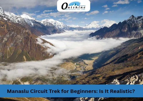
The Manaslu Circuit is one of Nepal's great remote treks. It follows the Budhi Gandaki river north from the foothills, climbs through Gurung and Tibetan-influenced villages, and crosses Larkya La at around 5,100 meters before dropping to the Annapurna side. October is prime season for it.
This autumn has been hard on the route. A flash flood near Namrung on September 6 destroyed two bridges and closed the trail until locals built a temporary crossing. A landslide above Samagaun on September 27 frightened trekkers and climbers in the village. The latest blow came early on October 11, when a flood down the Budhi Gandaki damaged the trail and bridges near Jagat and stranded more than 100 foreign tourists. Status has changed more than once, so many people are asking the same question: is the Manaslu Circuit open right now?
This page gives the answer one stage at a time, and it separates what has been confirmed from what we have not been able to confirm. Permit information comes from a notice by the Trekking Agencies' Association of Nepal (TAAN). Trail information comes from district administration notices, TAAN advisories, and news reports. We update the page when new information appears, and the date at the top shows the last check.
The Short Answer: Is the Manaslu Circuit Open?
Partly, and with care required. After the September 6 flood, the route reopened on September 8 using a community-built bypass with temporary wooden bridges near Namrung, and TAAN confirmed that permits were being issued for all Manaslu Conservation Area routes. The newest disruption is the October 11 Budhi Gandaki flood, which damaged the main trail and suspension bridges and halted tourist movement near Jagat. We found no official reopening date yet.
What is new since our October 12 update: slides have continued. A landslide dammed the Dhindhur river near Larke Bazar in Samdo around November 5, forming a shallow lake; the Manaslu Conservation Area Project (MCAP) said water was still flowing and there was no immediate danger. On Saturday, November 14, a large dry landslide came down at Thadobhyang, near Yaru Bridge in Yarubagar (Dharche Rural Municipality-1). Officials reported no casualties or damage, and said the debris was not expected to block the Budhi Gandaki. We found no official trail assessment yet.
What we cannot confirm is the condition of every stage. The newest reports on the Namrung crossing and the trail above Samagaun date from September 28, and we found no report on Larkya La or the road from Arughat to Soti Khola. On the positive side, stranded tourists were reported safe on October 11, and in September local crews restored a crossing within about two days. Until current reports confirm each stage, treat the route as disrupted and check before you go.
Trail Status at a Glance
Stage | What we know | Status | Last report |
|---|---|---|---|
Permits and checkpoints | TAAN said in early October that permits were being issued for all Manaslu Conservation Area routes; the MCAP checkpoint at Jagat was not affected by the October 11 flood | Confirm before booking | October 11 |
Arughat to Soti Khola road | Reports say the October 11 flood damaged settlements down the valley as far as Arughat; road status not confirmed | Needs a current check | October 11 |
Jagat to Deng | More than 100 foreign tourists stranded at Jagat; main trail and suspension bridges reported damaged | Disrupted | October 11 |
Namrung (Therang Khola crossing) | Temporary wooden crossing in use since September 8; no report yet on any effect of the October 11 flood | Needs a current check | September 28 |
Samagaun | Landslide above the village on September 27; no casualties or damage reported that morning | Needs a current check | September 28 |
Samdo and Dharamsala | No specific report found | Not confirmed | None found |
Larkya La Pass | District suspension issued September 6; we found no notice lifting it, and tourist movement was halted on October 11 | Not confirmed | None found |
Tsum Valley | Reports place the start of the October 11 flood in a side stream near Chumchet; TAAN had already advised waiting in early September | Needs a current check | October 11 |
A permit office being open is not the same as a clear trail. Checkpoints tell you where you can register. They do not tell you whether a bridge is standing.
Latest Disruption: The November 14 Landslide at Yarubagar
The slide. At about 8:30 am on Saturday, November 14, a massive dry landslide struck Thadobhyang, in Yarubagar, Dharche Rural Municipality-1, Gorkha. It occurred at Bagar, near Yaru Bridge, in an area across the Budhi Gandaki River.
Damage. The Gorkha Chief District Officer and the Assistant Chief District Officer said no human or physical damage had been reported so far, and a police team went to the site to assess it. Debris, including rocks and soil, reached the Budhi Gandaki. The Dharche chairperson and the District Police Office said it was not likely to obstruct the river, so no downstream risk was expected, though precautions were taken.
What we do not know. One outlet noted that the effect on nearby settlements and transport, and the chance of further slides, was still unclear, and that no official assessment had been released. The reports we found do not say which trek stage Yarubagar falls on or whether the trail was blocked. The area was already hit by the October 11 flood, when 18 stranded people there were rescued by helicopter. Ask your operator whether this section affects your route.
Early November: More Slides in the Upper Valley
The November 14 slide was not the first this month. Reports describe a run of dry landslides in northern Gorkha:
- Serang Gumba trail (Chum Nubri-5): a large dry landslide struck the trail in early November, by our reading of the Nepali date Kartik 17 (about November 3).
- Samdo (Chum Nubri-1): a landslide around November 5 dammed the Dhindhur river near Larke Bazar and blocked a tributary of the Budhi Gandaki, forming a shallow lake of about 500 square metres. On November 6, MCAP said water was still flowing and there was no immediate risk of a sudden breach, but asked residents to stay alert. The Nepali-to-English date conversions here are approximate, so confirm dates with the district office.
Together, these reports say the upper slopes remain unstable weeks after the floods.
The October 11 Budhi Gandaki Flood
The flood. Early on October 11, a flash flood carrying mud and debris came down the Budhi Gandaki after a dry landslide blocked the river. The exact cause is not officially confirmed. ICIMOD, citing preliminary accounts from authorities, said it may have come from the failure of a landslide-made river blockage near Chumchet. Other reports place the blockage between Lokpa and Chumling near the Tsum Valley entrance, and some residents pointed to the Syar Khola, a side stream. Tourism Times reported a suspension bridge at Nakchet swept away, a hydropower project camp and nearby houses washed out, and at least five villagers unaccounted for.
Tourists stranded. MCAP said more than 100 foreign tourists were stranded along the trail, including at Jagat, with helicopter rescues being arranged. Authorities rescued 321 people, including 12 foreigners, on October 12, and the army said the operation would continue. TAAN reported on October 14 that about 100 foreign tourists and 80 Nepali trekking staff were still waiting for rescue. We found no report of trekker injuries.
Bridges. One report quoting Gorkha's Assistant Chief District Officer said six bridges were swept away, two motorable and four suspension. We could not confirm that figure from an official notice.
Reopening. The main trail and bridges were damaged, and we found no official reopening date. The September recovery shows local crews can move fast, but treat any date you see online as unconfirmed until DAO Gorkha, TAAN, or MCAP confirms it.
Earlier Flood: September 6 at Namrung and the Two-Day Recovery
The flood. On the morning of Sunday, September 6, a flood in the Therang Khola at Namrung caused extensive damage to trekking trails, hotels, and hydropower projects. According to the Gorkha District Administration Office, it swept away the iron bridge connecting Chumnubri Rural Municipality wards 4 and 2, and the suspension bridge over the Budhi Gandaki River linking the area with the Namrung forest. Officials said the flood carried mud and debris after the river had been temporarily blocked near its source, and the surge raised the Budhi Gandaki enough to take out the second crossing. Four village houses and two small hydropower projects were also lost. No human casualties were reported, because residents fled once they learned the flood was coming. Authorities urged people living along the Budhi Gandaki to stay alert.
Trekkers held up on the trail. With both bridges gone, travellers could not move up or down the valley at Namrung. One local news report said hundreds of tourists heading toward Larkya La were stranded for lack of a bridge over the Budhi Gandaki, and a Namrung resident said both villagers and tourists were affected. The Gorkha District Administration issued a notice asking trekkers who were preparing to travel, or already on the route, to suspend their plans until further notice. We found no report of injuries among trekkers.
A fast local response. The community moved quickly. On the day of the flood, the Chumnubri Rural Municipality chairperson said locals could arrange a temporary crossing on foot. Within two days, on September 8, TAAN announced that the route had reopened on a community bypass with temporary wooden bridges. That is a fast recovery for a gorge section like this one, and it is the main reason trekking could restart this autumn. We covered it in Manaslu Circuit Trek Reopens 2026: Namrung Flood Update.
What is still open. The crossing is temporary. We found no confirmed date for permanent replacement bridges, and new rain can damage temporary spans. Ask your operator how groups are crossing now and when they last had a confirmed report from the trail. Once permanent bridges are in place and the upper trail is confirmed, the circuit should be back to normal conditions. Until then, keep a spare day in your plan.
What Happened: The Landslide and the Wider Picture
September 6: flood and suspension. Flash floods in the Therang Khola and the Budhi Gandaki swept away two bridges in Chumnubri Rural Municipality in Gorkha. The Gorkha District Administration Office suspended travel on the Manaslu and Larkya Pass routes until further notice and asked trekkers not to start or continue their trips. TAAN advised trekkers to delay Manaslu trips for a few days and to postpone Manaslu Base Camp and Larkya Pass.
September 8: bypass opened. TAAN announced that the route had reopened on a community bypass with temporary wooden bridges.
September 27: landslide above Samagaun. At about 3am, after days of heavy rain, a landslide came down above Samagaun. Trekkers, climbers, and expedition staff left their rooms and sheltered in the village. No casualties or damage were reported that morning. Some climbers on Manaslu retreated to lower altitude after the weather turned, and bad weather grounded rescue helicopters for several days.
October 11: Budhi Gandaki flood. A flash flood at about 4 a.m. damaged trekking trails and suspension bridges, stranded more than 100 foreign tourists at Jagat, and halted tourist movement. See the section above for details.
Early November: upper-valley slides. A dry landslide hit the Serang Gumba trail, and around November 5 another dammed the Dhindhur river near Larke Bazar in Samdo, forming a shallow lake.
November 14: Yarubagar landslide. A large dry landslide at Thadobhyang, near Yaru Bridge, reached the Budhi Gandaki. No casualties or damage were reported, and the river was not expected to be blocked.
Mud and rock slides also hit the Annapurna side of the circuit at the same time. Our separate report covers the Marsyangdi valley: Annapurna Circuit Trail Status: October 2026 Update. The Manaslu Circuit ends in that valley, close to where the Annapurna Circuit begins, so both reports matter if you plan to walk the full loop.
Why the Manaslu Route Is Prone to Disruption
The trail follows the Budhi Gandaki through a narrow gorge, and side streams like the Therang Khola drop steeply into it. After days of heavy rain, a small stream can carry rock and mud that a footbridge cannot withstand. Both autumn floods fit the pattern: a blocked stream released a surge of mud and debris, and the river then took out bridges and trail downstream. Many crossings on this route are suspension bridges and wooden spans, so one lost bridge can stop a whole day's walk.
The road to the start matters too. Most itineraries drive from Kathmandu to Soti Khola or Machha Khola, and landslides on that road can delay day one. At the top end, Larkya La is exposed to wind and fresh snow, and rain at lower altitude often means snow above 4,000 meters.
Stage by Stage: What to Ask Before You Go
Approximate altitudes are listed so you can see where the high sections begin. Sources differ by a few dozen meters.
Stage | Approximate altitude |
|---|---|
Soti Khola | 710 m |
Jagat | 1,340 m |
Deng | 1,800 m |
Namrung | 2,630 m |
Samagaun | 3,530 m |
Samdo | 3,860 m |
Dharamsala (Larkya La base) | 4,460 m |
Larkya La Pass | about 5,100 m |
Bimthang | 3,720 m |
Permits: Being Issued
TAAN has confirmed that permits for all trekking routes in the Manaslu Conservation Area are being issued. The Manaslu Circuit usually needs three permits: the Manaslu Restricted Area Permit (RAP), the Manaslu Conservation Area Permit (MCAP), and the Annapurna Conservation Area Permit (ACAP), plus a local municipality fee. The restricted area permit can only be obtained through a registered trekking agency. Since March 22, 2026, a single trekker can apply, but a licensed guide is still required at all times.
Arughat, Soti Khola, and Machha Khola
This is the road section at the start. We found no recent report on it. Ask your operator whether vehicles are reaching Soti Khola or Machha Khola, and whether the plan includes walking part of the road.
Yarubagar and the Lower Valley
The November 14 landslide at Thadobhyang, near Yaru Bridge, is the newest report from the lower valley. No casualties or damage were reported and the river was not expected to be blocked, but no official assessment of the trail had been released when we checked. Ask your operator whether groups are passing this area normally and whether any bridge or trail section was affected.
Jagat to Deng
Jagat is the first checkpoint and the entry to the restricted area. It was the main holding point for stranded trekkers after the October 11 flood. The MCAP checkpoint there was not affected, but the trail and bridges beyond it were reported damaged. Do not start until your operator confirms the route.
Namrung: The Temporary Crossing
This is the stage hit hardest by the flood. The route reopened on September 8 on temporary wooden bridges and a community bypass. Temporary crossings can be damaged by new rain, so ask your operator when they last had a confirmed report and how groups are crossing.
Samagaun: Check Before You Commit
Samagaun is where most itineraries spend an acclimatization day. The September 27 landslide came down above the village, and the last reports we found are from September 28. Ask whether lodges are open, whether the slope above the village is stable, and whether groups are staying there normally.
Samdo, Dharamsala, and Larkya La
We found no notice confirming crossings of Larkya La this autumn, and the September 6 district suspension has not been reported as lifted in anything we could find. This does not mean the pass is closed. It means we cannot confirm it from published notices, so ask your operator for the current position and whether a weather or snow hold is in place.
Larkya La is a long day. Groups usually start in the dark from Dharamsala, and wind builds by late morning. Your guide should check the forecast and the trail each morning, and the decision to go or wait belongs to them.
Tsum Valley
TAAN reported a landslide near Chaurikharka in early September and advised waiting. If you plan to add the Tsum Valley trek, ask for a current report on the trail to Lokpa and Chhekampar before you commit.
What This Means for Your Plans
If you are booked for the coming weeks. Ask your operator three things in writing: which sections of your itinerary use the Namrung crossing and the Samagaun slope, what the plan is if a bridge or the pass is closed, and when they last had a confirmed report from the trail. A clear answer to those questions tells you more than a general "it's open."
If you paused your plans. The October 11 flood has halted trekking for now, but the route recovered within about two days after the September flood. Autumn conditions are usually good into early November. Rescheduling is realistic, but the information gap above Namrung is a reason to keep your dates flexible and add a spare day.
If you are already on the trail. Check with your guide and guesthouse owners each morning. People who walked the section yesterday know more than any notice.
Your Manaslu Trek With Outshine Adventure
Outshine Adventure runs the 17-day Manaslu Circuit trek, and our guides and operations team follow notices from the district administration, TAAN, and the checkpoints.
- Permits: We arrange the Manaslu permits and the paperwork that goes with them.
- Daily decisions: Your guide checks the weather and the trail each morning and adjusts the day if needed. Acclimatization days stay in the plan.
- Updates: If a notice affects your dates, we contact you directly.
If you have questions about your dates or your route, message our team through our contact page, or by phone or WhatsApp at +977 9851126351. Tell us when you want to trek, and we will explain how the current conditions apply to your plan. You can also browse our featured trips, which include the Manaslu Circuit and the Tsum Valley trek.
Practical Preparation for an Autumn Manaslu Trek
- Add spare days. One or two days at the end of the itinerary absorb a bridge repair, a landslide delay, or a weather hold on Larkya La.
- Protect acclimatization days. The rest day at Samagaun is part of the plan. Skipping it raises the risk of altitude sickness before the pass.
- Pack for cold nights. Temperatures above Samagaun drop well below freezing. Bring layers, a warm hat, gloves, and a good sleeping bag. See our trekking equipment guide.
- Carry permit copies and the right insurance. Checkpoints check paperwork. Your policy should cover trekking above 5,000 meters and helicopter evacuation. See our travel insurance guide.
- Cross slide zones one at a time. Loose rock can fall for days after a slide. Follow your guide, move quickly through exposed sections, and do not stop under a slope.
- Watch for altitude symptoms. Report headache, nausea, or unusual tiredness to your guide at once. Going down is the safest response to worsening symptoms. Read our high altitude sickness guide.
How to Check Conditions Before You Travel
Bridges and trails can change faster than any web page can be edited. For the latest information, check these sources:
- TAAN official page and TAAN Facebook page
- Gorkha District Administration Office notices
- Your operator's most recent field report
Conclusion
The Manaslu Circuit is not closed for good, but it is not fully confirmed either. The route reopened on a temporary bypass two days after the September 6 flood, and permits were being issued. The October 11 Budhi Gandaki flood, the September 27 landslide above Samagaun, and the lack of recent reports on the upper trail and Larkya La are real gaps. On the positive side, stranded tourists were reported safe, and local crews have restored crossings quickly before. Rely on a current report from your operator, not on this page alone.
If your dates are flexible, keep a spare day and ask for written updates. If your dates are fixed, ask your operator the three questions above before you pay for the trek. Contact the Outshine Adventure team through our contact page or on WhatsApp and we will tell you where things stand for your dates.
Frequently Asked Questions
Is the Manaslu Circuit open in October 2026? Partly. The route reopened on September 8 after the Namrung flood and TAAN said permits were being issued, but an October 11 flood damaged the trail and bridges near Jagat and halted tourist movement. We found no official reopening date, so check with your operator before you travel.
What happened on the Manaslu Circuit in September 2026? A flash flood on September 6 destroyed two bridges near Namrung, and the district administration suspended travel. The route reopened on September 8 on a community bypass with temporary wooden bridges. On September 27, a landslide came down above Samagaun after days of heavy rain.
What caused the Budhi Gandaki flood? The October 11 flood may have been triggered by the failure of a temporary river blockage created by a landslide near Chumchet, according to preliminary accounts reviewed by ICIMOD. The September 6 flood in the Therang Khola carried mud and debris after the stream was temporarily blocked near its source.
Were trekkers stranded by the flood? Yes. After the October 11 flood, more than 100 foreign tourists were reported stranded at Jagat, all in safe locations, with helicopter rescues being arranged. In September, one report said hundreds of tourists heading toward Larkya La were held up at Namrung. We found no report of trekker injuries.
How quickly did the route reopen? After the September 6 flood, two days: on September 8, a community bypass with temporary wooden bridges opened. After the October 11 flood, we found no reopening date yet.
Are Manaslu permits available right now? TAAN said in early October that permits for all Manaslu Conservation Area routes were being issued, and the Jagat checkpoint was not affected by the October 11 flood. Confirm with your agency before paying, because the trail itself is damaged.
Is Larkya La Pass open? We could not confirm this from published notices. A district suspension was issued on September 6, and we found no notice lifting it or reporting a crossing. Ask your operator for the current position.
Is the Namrung bridge repaired? The route reopened on September 8 using temporary wooden bridges and a community bypass. We found no report of permanent repairs or a confirmed date for them, so ask how groups are crossing now.
Is Samagaun safe after the landslide? No casualties or damage were reported on the morning of September 27, and trekkers sheltered in the village. Check the current state of the slope and the lodges with your operator before you plan a stay there.
Can I trek the Manaslu Circuit solo in 2026? Since March 22, 2026, a solo trekker can apply for the Restricted Area Permit through a registered agency. A licensed guide is still required for the whole route.
What permits do I need for the Manaslu Circuit? You need the Manaslu Restricted Area Permit, the Manaslu Conservation Area Permit, and the Annapurna Conservation Area Permit, plus a local municipality fee. Your agency arranges the restricted area permit.
Is autumn a good time for the Manaslu Circuit? Yes. October and November usually bring clear skies and stable weather. This year, keep your dates flexible and add a spare day.
How often is this page updated? We revise it when TAAN, the district administration, or our field team report a change. The "Last updated" date at the top shows the last check.
Related Reading
- Manaslu Circuit Trek package: itinerary, cost, and availability
- Tsum Valley Trek (Manaslu)
- Manaslu Trekking packages
- Manaslu Circuit Trail Status: October 2026 Update
- Manaslu Circuit Trek Reopens 2026: Namrung Flood Update
- Manaslu Circuit Trek Closed 2026: Complete Update on the Namrung Flood
- Is It Safe to Book a Nepal Trek? Honest Answer After the Floods
- Manaslu Circuit vs Annapurna Circuit: Which Should You Choose in 2026
- Annapurna Circuit Trail Status: October 2026 Update
- Nepal Travel Safety and Security Guide
- TAAN on Facebook