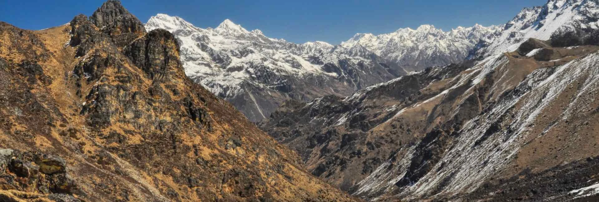
What Happened in Nepal on August 26, 2026
On the morning of August 26, 2026, a massive glacier and rockslide collapse near the Nepal-Tibet border triggered a chain reaction that few people in the region saw coming. The collapse fell into the Lhende River on the Tibetan side, which feeds into the Bhote Koshi River and eventually the Trishuli River inside Nepal. Within minutes, a wall of water estimated to have risen as much as nine meters in just thirty minutes tore down a roughly seventy-two kilometer stretch of the Trishuli corridor.
The flood swept through settlements in Rasuwa, Nuwakot, Dhading, Gorkha, Tanahun, Nawalparasi, and Chitwan districts. It also destroyed the Gyirong Port complex on the China-Nepal border, a major trade and tourism gateway between the two countries. Bridges vanished, roads were washed out, hydropower stations were damaged, and dozens of schools were affected.
Current figures, per NDRRMA (as of September 1, 2026): at least 1,010 people dead, 1,473 injured, 11,814 rescued, and 3,916 still reported missing in Nepal, including 583 foreign nationals from 38 countries. On the Tibetan side, Chinese state media report 16 deaths and 546 missing, including 261 foreign nationals. Nepal's Ministry of Health has said only about 4% of the roughly 900 recovered bodies have been formally identified so far, which is part of why the missing count remains so high even as more bodies are found.
These numbers will keep moving; for the current count, go directly to NDRRMA's official updates or Nepal Police rather than relying on any single article, including this one.
For readers who want the full picture—current death toll and missing persons figures, the status of trapped hydropower workers, how families can search for missing relatives, and the official, government-endorsed way to donate—our team has put together a continuously updated resource: Nepal Flood 2026: Rescue, Relief & Donate Full Update. It draws on official Nepal Police bulletins, NDRRMA updates, and government sources and is refreshed as the situation develops.
Which Districts Were Hit the Hardest
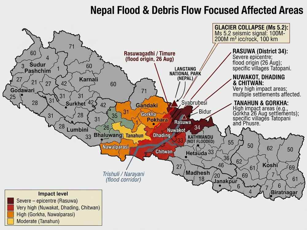
Based on official casualty data and impact assessments released between August 27 and 28, the severity levels break down roughly like this:
- Severe, epicenter: Rasuwa district, particularly Timure, Syabrubesi, and Betrawati, close to where the flood originated
- Very high impact: Nuwakot, Dhading, and Chitwan, all downstream along the Trishuli River
- High impact: Gorkha and Nawalparasi, further along the flood path
- Moderate impact: Tanahun, at the outer edge of the affected corridor
These districts sit along a single connected river system, the Bhote Koshi flowing into the Trishuli. That geography matters enormously when it comes to understanding why the rest of Nepal was never actually in the flood's path.
Kathmandu Was Not Affected by the Flooding
One detail that many travelers overlook is that Kathmandu itself sits outside the Trishuli flood corridor and was not affected by the flooding. The capital city continues to operate normally, with flights, hotels, and daily life proceeding as usual. If your itinerary starts or ends in Kathmandu, there is no reason for concern on that front.
Is It Safe to Trek in Nepal Right Now
This is the question on most travelers' minds right now, and it deserves a real answer, not a vague reassurance. So let's be direct: yes, it is safe to trek in Nepal right now, in almost every part of the country.
Nepal is not a single valley or a single trail. It is a vast, geographically layered nation stretching nearly 800 kilometers east to west, home to dozens of distinct river systems, mountain ranges, and trekking regions that operate almost entirely independently of one another. The flood of August 26, 2026 was a genuinely catastrophic incident, but it was also a geographically contained one. It originated at a single point near the Nepal-Tibet border, traveled down a single connected waterway, the Bhote Koshi into the Trishuli, and struck a single 72-kilometer corridor running through Rasuwa, Nuwakot, Dhading, Gorkha, Tanahun, Nawalparasi, and Chitwan.
That is a serious and heartbreaking disaster for the communities in its path. But it is also, in the most literal geographic sense, one river system out of many. It did not touch the Dudh Koshi valley that carries trekkers to Everest. It did not touch the Budhi Gandaki that winds through Manaslu. It did not touch the Marsyangdi or Kali Gandaki valleys of the Annapurna region, and it came nowhere near the remote eastern watersheds of Kanchenjunga or Makalu. These are not adjacent trails that got lucky. They are entirely separate drainage systems, often separated from the flood corridor by entire mountain ranges, hundreds of kilometers of distance, and, in some cases, days of travel.
Here is a breakdown of the major trekking routes and their current status.
Everest Region: Fully Open
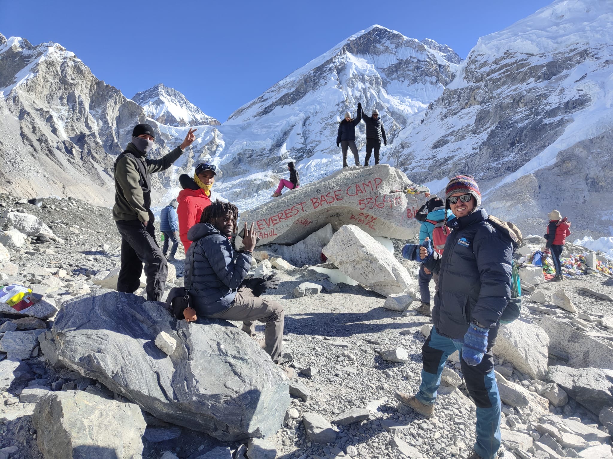
The Everest region is Nepal's most famous trekking destination, and every part of it is running exactly as planned this season. The classic route begins with a short, dramatic mountain flight from Kathmandu into Lukla, at roughly 2,860 meters, where the trail officially starts. From there, trekkers follow the Dudh Koshi river valley through Phakding and into Namche Bazaar, the bustling Sherpa trading hub that also serves as the main acclimatization stop. From Namche, the trail climbs steadily through Tengboche, home to one of the region's most iconic monasteries, and continues through Dingboche and Lobuche before reaching Gorak Shep, the last settlement before Everest Base Camp itself at around 5,364 meters. Most itineraries also include a climb up Kala Patthar, at about 5,545 meters, which offers the single best close-up view of Mount Everest's summit anywhere on the trek.
The full round trip typically takes twelve to fourteen days including acclimatization days, and it falls into the moderately strenuous to strenuous category, mainly because of altitude rather than technical difficulty. Trekkers who want more variety often extend into the Gokyo Valley, home to a chain of turquoise glacial lakes and the Gokyo Ri viewpoint, or tackle the more demanding Everest Three Passes trek, which links Kongma La, Cho La, and Renjo La into one extended loop. Permits required are the Sagarmatha National Park entry permit and the local Khumbu Pasang Lhamu Rural Municipality entry fee, both straightforward to arrange in Kathmandu or on arrival in Lukla. None of this infrastructure, none of these villages, and none of these trails sit anywhere near the Bhote Koshi or Trishuli flood corridor, which is why Lukla flights and the entire Khumbu region are operating on a completely normal schedule.
See the full route, itinerary, and cost on the Everest Base Camp Trek package with Outshine Adventure.
Manaslu Region: Fully Open
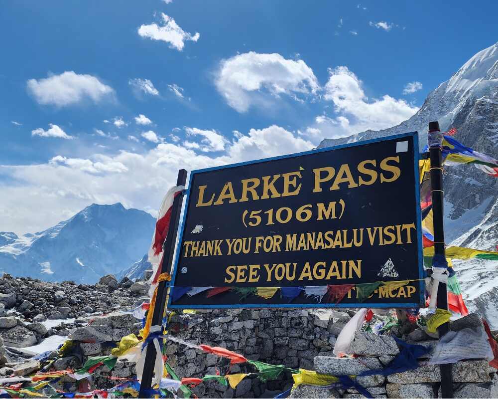
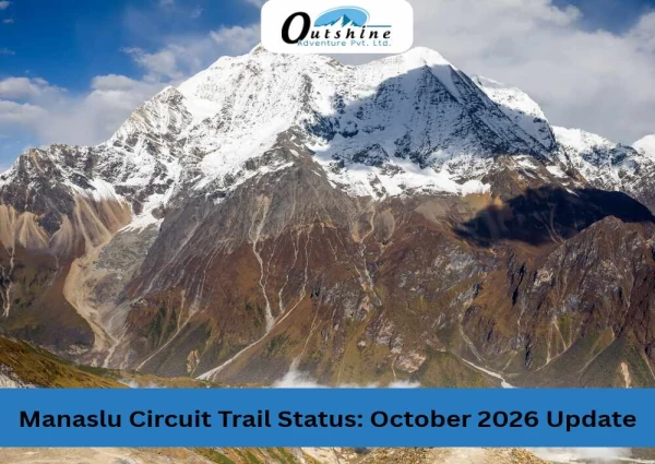
The Manaslu Circuit is often described as the quieter, wilder cousin of the Annapurna and Everest routes, and it remains fully open and safe this season. The trek begins at Machha Khola or nearby Soti Khola, reached by road from Kathmandu, and follows the Budhi Gandaki river valley north through Jagat, Deng, and Namrung. As the trail climbs, the landscape and culture shift noticeably from Hindu hill villages to Tibetan Buddhist communities, with mani walls, chortens, and monasteries becoming a constant presence. Many trekkers add a side trip into the Tsum Valley, a remote, deeply traditional valley that only opened to foreign trekkers in the past two decades.
The main trail continues through Shyala and Samagaon, where trekkers typically take an acclimatization day to hike up toward Manaslu Base Camp itself at around 4,800 meters, with views of the Manaslu Glacier and Pungyen Gompa monastery above the village. From Samagaon, the route pushes on through Samdo and Dharamsala before the trek's high point, the Larke La Pass at 5,106 meters, a demanding but spectacular crossing that drops trekkers down into the Manang district and connects into the wider Annapurna region near Dharapani and Besisahar. The full circuit generally takes fourteen to eighteen days and is considered a restricted area trek, meaning it requires a Restricted Area Permit, a Manaslu Conservation Area Permit, an Annapurna Conservation Area Permit for the final stretch, a licensed guide, and a minimum of two trekkers in your group, all of which must be arranged through a registered Nepal-based trekking company in advance. The one thing worth knowing on the access side is a damaged bridge on the Malekhu to Dhadingbesi road, a completely separate, minor detail from the flood corridor itself, and local operators are already routing vehicles through Benighat to Arughat instead, so it has no real effect on your trekking days.
Explore the full itinerary on the Manaslu Circuit Trek package, or add the remote Tsum Valley extension to your journey.
Annapurna Region: Fully Open
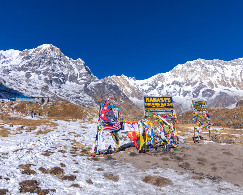
The Annapurna region remains Nepal's most popular trekking area, and every one of its major routes is open. The Annapurna Base Camp trek usually starts with a drive from Pokhara to Nayapul, followed by the walk through Birethanti and Ghandruk, a picturesque Gurung village, before climbing through rhododendron and bamboo forest to Chhomrong, Dovan, and finally the Annapurna Sanctuary itself, a natural amphitheater surrounded by Annapurna I, Machhapuchhre, and Hiunchuli, at roughly 4,130 meters. This route takes about seven to eleven days round trip and is considered moderate in difficulty, making it one of the more accessible high-altitude treks in Nepal.
The longer Annapurna Circuit takes a different approach entirely, looping around the Annapurna massif from Besisahar through the Marsyangdi valley, climbing gradually through Chame, Pisang, and Manang for acclimatization, then crossing the dramatic Thorong La Pass at 5,416 meters before descending into the high desert landscape of Muktinath and Jomsom on the Kali Gandaki side. This circuit typically runs fourteen to eighteen days and offers some of the most varied scenery in the entire Himalaya, from subtropical forest to high alpine desert in a single trek. Shorter options in the same region include the Ghorepani Poon Hill trek, a four to five day route famous for its sunrise viewpoint over the Annapurna and Dhaulagiri ranges, and the Mardi Himal trek, a quieter ridge walk to a base camp at around 4,500 meters. All of these routes fall under the Annapurna Conservation Area Permit system, and none of them were affected by the flood corridor. A brief closure on the Kathmandu-Pokhara highway cleared within a day and never touched the trekking trails themselves, and flights to Pokhara and Jomsom continue running as usual.
Compare full details on the Annapurna Base Camp Trek package and the Annapurna Circuit Trek package.
Kanchenjunga Region: Fully Open
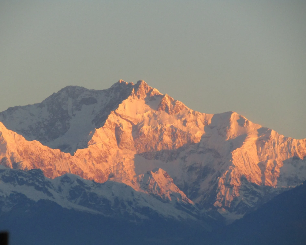
Kanchenjunga sits in Nepal's far eastern corner, home to the world's third highest mountain, and this remote, restricted region continues to operate exactly as normal. The trek typically begins with a flight to Bhadrapur followed by a long drive or additional flight to Taplejung, from where the trail heads north through Sherpa, Limbu, and Rai villages into increasingly wild and undeveloped terrain. Most itineraries explore both the north and south base camps, giving trekkers close views of Kanchenjunga's five summits along with neighboring peaks like Jannu.
This is a longer, more demanding expedition style trek, generally running eighteen to twenty two days round trip, and it earns its reputation as one of the wildest, least crowded trekking experiences left in Nepal, with far fewer teahouses and far more genuine wilderness camping involved. As a restricted region, it requires a Kanchenjunga Restricted Area Permit, a Kanchenjunga Conservation Area Permit, a licensed guide, and a minimum group size of two trekkers, all arranged in advance through a registered operator. None of the river systems, trailheads, or access roads in this region have any connection whatsoever to the Bhote Koshi flood corridor on the opposite side of the country, and conditions here remain completely unaffected.
Full details and itinerary are on the Kanchenjunga Base Camp Trek package, including the extended Kanchenjunga Circuit Trek covering both base camps.
Makalu Region: Fully Open
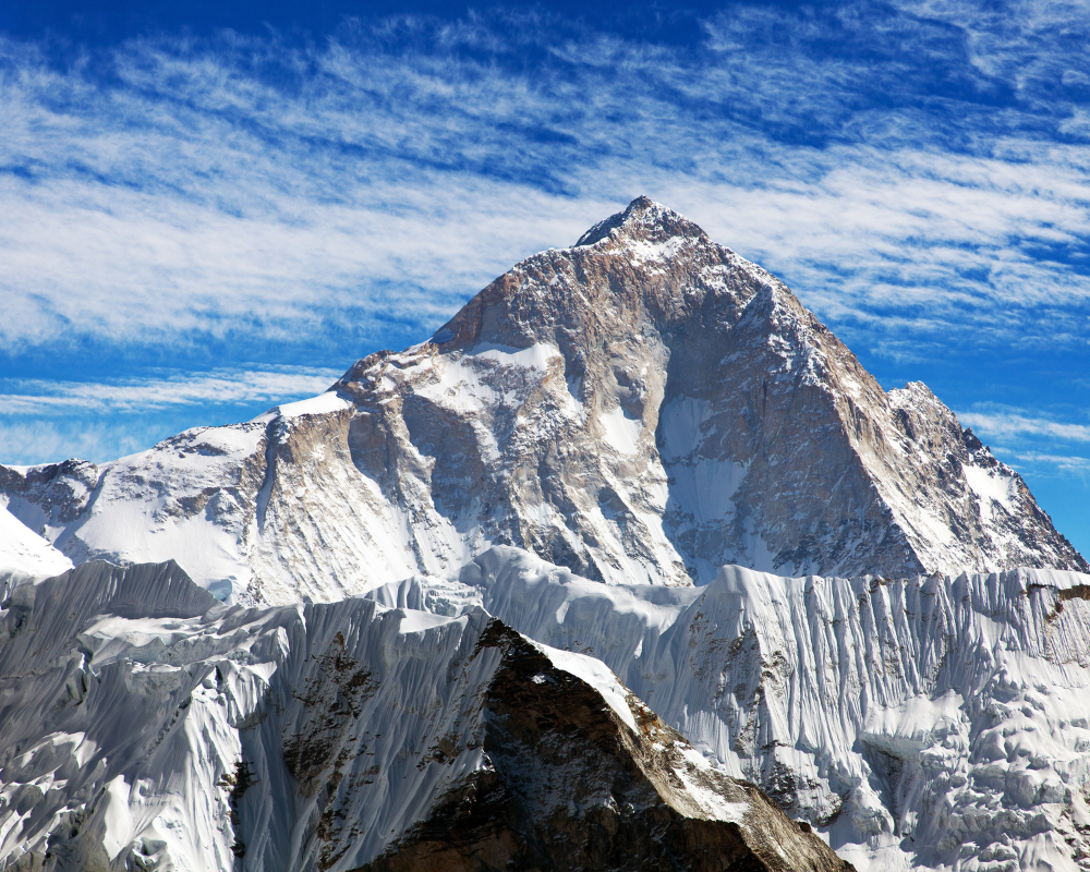
Makalu, home to the world's fifth highest mountain at 8,485 meters, sits within the Makalu Barun National Park in eastern Nepal, and this trek remains fully open and unaffected this season. The route typically begins with a flight to Tumlingtar followed by a drive to Num, then descends and climbs through the Arun and Barun river valleys via Seduwa, Tashigaon, and Khongma, passing through dense rhododendron forest, high alpine meadows, and small Sherpa and Rai settlements along the way. Wildlife sightings, including musk deer, langur monkeys, and occasionally the elusive blue sheep, are a genuine part of the experience in this pristine conservation area.
Higher up, the trail passes Yangle Kharka and Dobato before reaching Makalu Base Camp itself, with side trips often taken to the Swiss Base Camp on the banks of Barun Pokhari and to a ridge viewpoint offering close range views of Makalu alongside Everest, Lhotse, Baruntse, and Chamlang. The full trek generally runs eighteen to twenty two days and is rated strenuous, both for its altitude and its genuinely remote, undeveloped trail conditions. Permits required include the Makalu Barun National Park entry permit and, for the upper sections, a Restricted Area Permit arranged through a licensed operator. Like Kanchenjunga, Makalu's entire river and trail network is geographically isolated from the flood corridor in the north central part of the country, and the region remains completely open for trekkers this season.
See the complete route and cost on the Makalu Base Camp Trek package.
Why These Regions Were Never in the Flood's Path
The flood began when a glacier and rockslide collapsed near the Nepal-Tibet border and fell into the Lhende River, which feeds into the Bhote Koshi and then the Trishuli River. That single, connected waterway carried the flood south through Rasuwa, Nuwakot, Dhading, Gorkha, Tanahun, Nawalparasi, and Chitwan districts.
Here is the key fact that puts most travelers' minds at ease: Nepal's other major trekking regions sit in entirely separate river systems that have no physical connection to the Bhote Koshi or Trishuli.
- The Everest region drains into the Dudh Koshi River
- The Manaslu region drains into the Budhi Gandaki River
- The Annapurna region drains into the Marsyangdi and Kali Gandaki rivers
- Kanchenjunga and Makalu, both in far eastern Nepal, sit nowhere near the affected corridor at all
None of these watersheds were ever near the water. That is not a matter of luck or a temporary reprieve, it is simply geography, and it is why these trails remain exactly as walkable and scenic today as they were before August 26.
Kathmandu itself also sits outside the flood corridor and was not affected. Flights, hotels, and city life continue as normal, so your trip's starting and ending point is unaffected regardless of which region you choose to trek.
The One Exception: Langtang Valley
Langtang is the one trekking region that sits directly within the flood corridor. The trail itself, from Syabrubesi up to Langtang Village and Kyanjin Gompa, has not been reported as directly damaged but the access road through Dhunche to Syabrubesi, and the wider Rasuwagadhi, Timure, Syafrubesi corridor, remains closed. Nepali authorities currently advise against travel into that corridor entirely. Local operators are estimating the route may not be workable again until late September 2026, weather and inspections permitting treat that as an estimate, not a booking guarantee. If you have a Langtang or Gosaikunda trek booked this season, this is the one itinerary that needs a direct conversation with your operator, not a general reassurance. Every other major trekking destination in Nepal, including all five regions described above, falls outside the affected zone and remains open.
How to Plan Your Trek with Confidence This Season
- Choose a safe, unaffected region. Everest, Annapurna, Manaslu, Kanchenjunga, and Makalu are all open and running normally, giving you five excellent options to choose from.
- Book with a licensed, registered local operator. Verify their company registration number, tourism license, and head guide license before paying a deposit. Outshine Adventure is government registered (License No. 1223/067) and can be reached directly through the official Outshine Adventure website to confirm current trail conditions before you book.
- Confirm conditions close to your departure date. Nepal's monsoon weather can shift quickly, so a same day update from your operator is always more reliable than older headlines.
- Get travel insurance with helicopter rescue coverage. This is smart practice for any Himalayan trek, flood season or not.
- Build in a flexible day or two. A little buffer time in Kathmandu at either end of your trip makes any minor itinerary adjustment easy to absorb.
Nepal Is Open, and Most of It Is Completely Safe to Trek
If you are wondering whether to cancel or postpone your Nepal trek because of the flood news from late August 2026, here is the reassurance you are looking for: you can. Everest Base Camp, the Annapurna Circuit, Annapurna Base Camp, the Manaslu Circuit, Kanchenjunga Base Camp, and Makalu Base Camp are all open, all operating on their regular schedules, and all considered safe for trekkers right now. Flights, teahouses, permits, and trail conditions in these regions are functioning exactly as they were before the flood.
Browse the full range of Nepal trekking packages with Outshine Adventure to see current availability for the season ahead.
A serious flood did strike northern Nepal on August 26, 2026, and it caused real damage in one specific river corridor. But Nepal is a vast, geographically diverse country, and a single river system does not represent the whole Himalaya. Once you understand the geography, it becomes clear just how much of Nepal remains completely untouched and ready to welcome trekkers this season.
Trek With Confidence This Season
Nepal's trekking regions, from Everest to Annapurna, Manaslu, Kanchenjunga, and Makalu, remain open, running, and ready for the season ahead, and there is no reason to let recent headlines hold you back from a trip you have been planning. So if you've been holding off, waiting to see how things unfold, you now have your answer: the mountains are open, the trails are walking exactly as they were before the flood, and there is no geographic or practical reason to delay a trek you've been dreaming about.
A Final Word: Trek Safely, Stay Alert, No Matter Which Route You Choose
Nepal's mountains are open, welcoming, and, region by region, genuinely safe to trek this season. But that reassurance is not an invitation to let your guard down, and it should never be mistaken for one. Every trekker, whether you are headed to the well trodden trail to Everest Base Camp, the quiet forests of Makalu, or the high passes of Manaslu, is walking into a live, ever changing mountain environment. The same monsoon patterns, glacial systems, and steep terrain that make the Himalaya so extraordinary are also what make a measure of caution non negotiable, in every region, on every route, in every season.
This applies regardless of which trail you pick and regardless of how calm conditions currently are. Weather in the high mountains can turn in hours, not days. A river that looks shallow and lazy in the morning can rise dramatically by afternoon. A clear trail can be blocked by a landslide overnight. None of this is unique to the areas touched by the August 2026 flood, it is simply the nature of trekking at altitude in a young, geologically active mountain range, and every trekker on every route should carry that awareness with them from the first day to the last.
A few habits make the real difference between a trek that stays an adventure and one that turns into an emergency:
- Always trek with a licensed guide, and follow their judgment without hesitation, especially around water crossings, weather calls, and route changes. Their read of local conditions is worth more than any itinerary. (Operators like Outshine Adventure, with government-licensed guides who work these trails year-round, are exactly the kind of trustworthy, experienced presence you want beside you when conditions shift unexpectedly.)
- Check conditions every single morning, not just before you leave home. Ask your guide or teahouse host about the specific day's weather, river levels, and trail status before setting out.
- Never cross a swollen or fast moving river or stream, no matter how narrow or shallow it looks from the bank. Wait it out, or take the detour. Patience costs hours, a bad crossing can cost everything.
- Carry comprehensive travel insurance with helicopter rescue coverage, and know exactly how to activate it before you need it, not after.
- Register your trek and share your itinerary, whether through your operator, your embassy, or a trusted contact back home, so that someone always knows roughly where you are.
- Keep a fully charged phone, a power bank, and a basic first aid kit on you at all times, along with the local emergency numbers and your guide's contact saved and accessible offline.
- Listen to your body and to your guide equally. Altitude sickness, exhaustion, and sudden weather shifts do not announce themselves politely, and turning back is always the right call when either your body or your guide tells you to.
- Build flexibility into your itinerary. An extra buffer day, whether for weather, altitude, or simply an unplanned detour, is what allows a trek to bend without breaking when conditions shift unexpectedly.
Nepal's trekking regions, from Everest to Annapurna, Manaslu, Kanchenjunga, and Makalu, remain open, running, and ready for the season ahead, and there is no reason to let recent headlines hold you back from a trip you have been planning. Just carry your alertness with you every step of the way, because in the Himalaya, preparation and presence of mind are what turn a spectacular trek into a safe one.
Frequently Asked Questions About Trekking in Nepal After the August 2026 Flood
Is it safe to trek in Nepal right now?
Yes, for most of the country. The August 26, 2026 flood was confined to the Bhote Koshi–Trishuli corridor, running through Rasuwa, Nuwakot, Dhading, Gorkha, Tanahun, Nawalparasi, and Chitwan. Everest, Annapurna, Manaslu, Kanchenjunga, and Makalu sit in entirely separate watersheds and are operating normally.
What is the current death toll and how many people are missing? Per NDRRMA as of September 1, 2026: at least 1,010 dead, 1,473 injured, 11,814 rescued, and 3,916 missing in Nepal (including 583 foreign nationals). These figures are still being updated, check NDRRMA directly for the current count.
Which trekking region was actually affected by the flood?
Langtang Valley is the one exception. It sits directly within the flood corridor, and its main access road has suffered serious damage. This is the only major trekking region where a delay or reroute currently makes sense.
Was Kathmandu affected by the flooding?
No, Kathmandu sits outside the Trishuli flood corridor entirely. Flights, hotels, and daily life in the capital continue as normal, so your trip's starting and ending point is unaffected regardless of which region you choose.
Should I cancel or postpone my Nepal trek because of the flood?
For any region other than Langtang or Gosaikunda, there's no need to based on current information, but confirm conditions close to your departure date using the official sources linked above.
How can I confirm current trail conditions before I book?
Book with a licensed, registered local operator who can confirm real-time trail, road, and permit status. Outshine Adventure is government registered (License No. 1223/067) and can be reached directly to confirm current conditions before you commit to a booking.
Where can I find verified updates on the flood itself, rather than trekking conditions?
Go directly to NDRRMA, the Nepal Police missing/unidentified persons registry, and Nepal's Ministry of Foreign Affairs for official figures, or your own country's embassy for nationality-specific guidance and the government-endorsed disaster relief fund.
Why Outshine for Your Next Trip
In a season like this one, when headlines are moving faster than trail conditions, the difference between a canceled trip and a great one usually comes down to the operator behind it. This is exactly the moment where an established, government-licensed local company earns its value not just for logistics, but for accurate, on-the-ground judgment about which routes are genuinely clear.
Outshine Adventure stands out among Nepal trekking operators as a fully registered, licensed company (License No. 1223/067) with direct, current knowledge of conditions across every region covered here Everest, Annapurna, Manaslu, Kanchenjunga, and Makalu. Rather than relying on outdated news coverage, our team can confirm real-time trail, road, and permit status before you commit to a booking, and route around minor, unrelated disruptions (like the Malekhu–Dhadingbesi road detour) the way only an operator working the ground every day can.
Browse the full range of Nepal trekking packages with Outshine Adventure to see current availability for the season ahead, or reach out directly for a same-day conditions check before you book.
.webp)