.webp)
Nepal's trekking industry has historically operated on a fixed seasonal calendar: spring (March–May) and autumn (late September–November) as the two reliable windows, monsoon (June–August) and deep winter (December–February) as the ones to avoid unless you had a specific reason to go. That calendar was built on decades of relatively stable weather patterns in the Nepal Himalaya. Over the past decade, research institutions studying the region have documented measurable shifts in temperature, precipitation, and glacial conditions across the Hindu Kush Himalaya, shifts that are now directly affecting trail conditions, pass accessibility, and monsoon timing on Nepal's major trekking routes. The following is a summary of the documented data, followed by what it means for planning a trek in 2026/2027.
Key facts:
- The Hindu Kush Himalaya (HKH) region (a 3,500 km mountain belt spanning eight countries, including Nepal) is warming at roughly twice the global average rate, per the International Centre for Integrated Mountain Development (ICIMOD).
- Even if global warming holds at 1.5°C, the HKH region is projected to warm an additional 0.3°C to 0.7°C above that global figure.
- Glaciers across the region are projected to lose at least one-third of their volume by 2100, even under the most optimistic emissions scenarios; under higher-emissions pathways, losses in the Eastern Himalaya (where Nepal sits) could reach 75%.
- These figures come from ICIMOD's Hindu Kush Himalaya Assessment, compiled by more than 300 researchers over four years and published by the Kathmandu-based intergovernmental research body that has studied this region for decades.
These numbers are the mechanism behind three measurable, on-the-ground changes trekkers are now planning around: shifting monsoon timing, irregular snowfall at altitude, and changing trail conditions near glacial terrain. They are not projections for some distant future; they are already showing up in current trip reports, permit data, and route advisories.
This is not a story about Nepal becoming unsafe to trek in. Nepal remains one of the most-trekked destinations in the world, and hundreds of thousands of people complete treks here safely every year. What has changed is the degree of predictability around when and where conditions are most favorable: a planning question, not a safety verdict. If you're booking a trek for 2026/2027 or beyond, understanding how seasonal patterns have shifted will directly affect which route fits your dates, when you should go, and what belongs in your pack.
Why the Himalayas Are Warming Faster Than Almost Anywhere Else on Earth
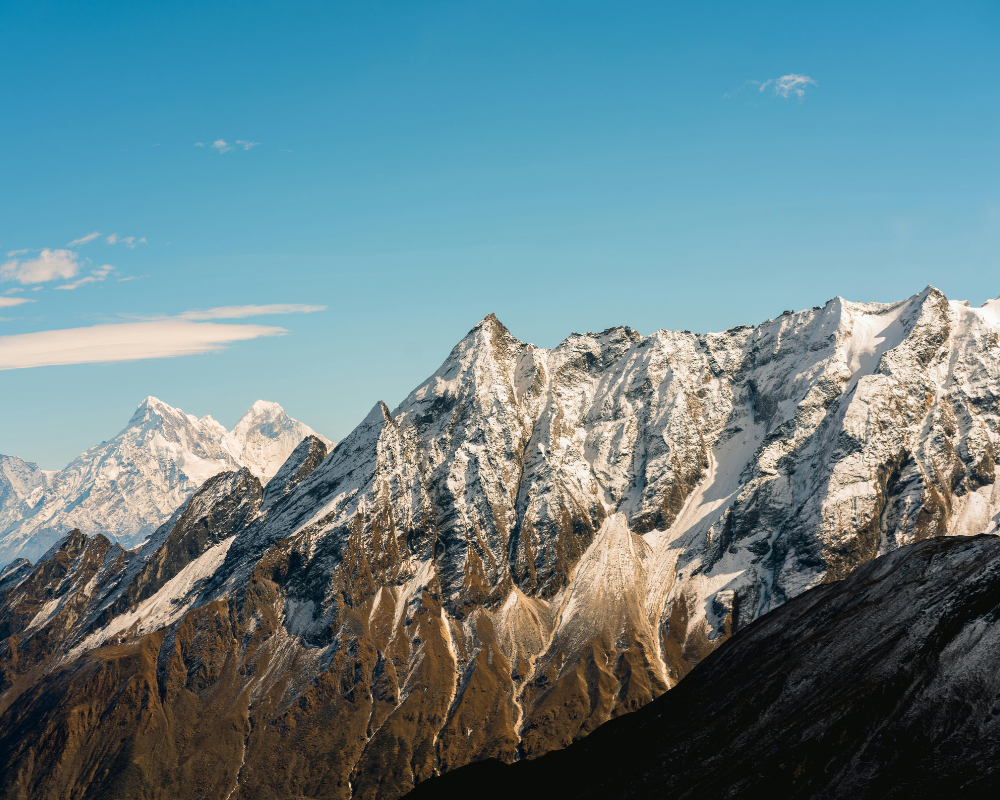
High-altitude zones in the HKH region are warming even faster than the lowlands below them, a pattern known as elevation-dependent warming, and one ICIMOD has documented consistently across its assessments. This isn't abstract if you're planning to walk through this terrain. It shows up on the ground in three concrete ways.
Glacial melt is reshaping the trail itself. Routes that skirt glacial lakes and moraine fields (the Everest Base Camp trail, the Gokyo Lakes route, sections of the Annapurna Circuit near the high passes) are showing more exposed rock and less stable moraine than they did ten or fifteen years ago. Trails aren't vanishing overnight, but certain stretches now demand more caution, and the risk of a glacial lake outburst flood (GLOF), where a swollen glacial lake breaches its natural dam and sends a wall of water and debris downstream, has become something local authorities and trekking operators actively monitor rather than treat as a once-in-a-generation freak event.
The monsoon has gotten harder to pin down. It used to arrive and retreat on a fairly dependable schedule, roughly June through August. These days, early or delayed onset is common enough that it's no longer a surprise, and that unpredictability bleeds into the shoulder months, which happen to be exactly the window most trekkers rely on for timing their departure.
Snowfall at altitude has gotten erratic. Instead of the predictable winter snow that used to open and close specific high passes like clockwork, several regions are now seeing out-of-season snow dumps in what should be dry months, paired with thinner-than-usual snowpack in what should be the heavy season. That matters most on high-pass routes: Thorong La on the Annapurna Circuit, or the passes on the Everest Three Passes trek, where a pass being open or closed can make or break an entire itinerary.
Spring and Autumn Still Win: The Margins Have Just Gotten Thinner
Here's the reassuring part: autumn (roughly late September through late November) and spring (March through May) are still, hands down, the most reliable windows for trekking in the Nepal Himalaya. That hasn't changed, and it's not likely to change anytime soon. What has changed is how much wiggle room sits around the edges of those windows.
Trekkers used to be able to book the very first week of a season and feel confident about it. These days, the early and late edges of both spring and autumn carry noticeably more variability in visibility, precipitation, and general trail conditions than they did a decade back. It doesn't mean those weeks are off-limits; plenty of successful treks still happen in early March or late November, but the safety margin has narrowed.
If your travel dates have any flexibility at all, aim for the heart of the season rather than its edges, roughly mid-October through mid-November, or mid-April through mid-May. Those windows still deliver the classic combination of clear skies, stable temperatures, and dependable trail conditions that made Nepal's reputation in the first place.
The Surprise Winner: Rain-Shadow Regions
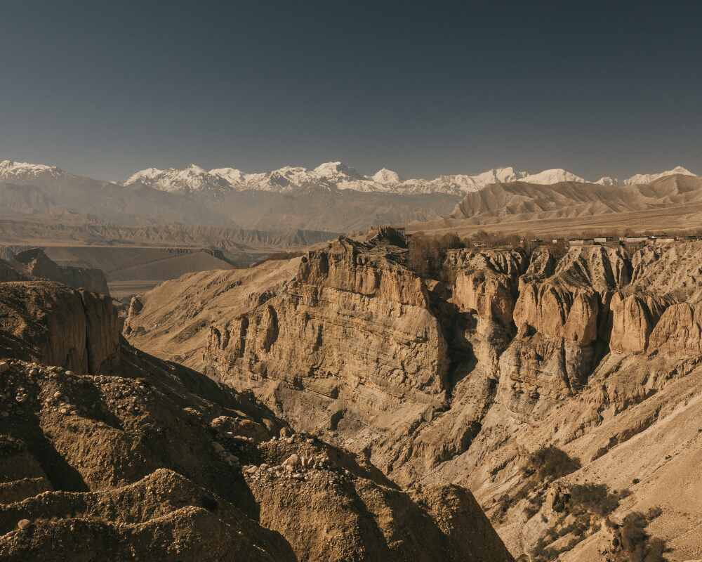
There's a genuinely positive angle buried in all of this, and it doesn't get talked about nearly enough. As monsoon rainfall has intensified across central and eastern Nepal, the rain-shadow regions tucked behind the main Himalayan range, including Upper Mustang, Dolpo, and the Manang-to-Jomsom stretch of the Annapurna Circuit, have stayed comparatively dry and are becoming viable trekking destinations even during months that used to be written off entirely.
These aren't new discoveries; local operators have known about the rain-shadow effect for as long as trekking tourism has existed in Nepal. What's new is how much more attractive these regions look now, given how much less predictable the traditional peak-season windows have become elsewhere. If your dates are locked in and they happen to fall outside the classic spring-autumn window, Upper Mustang or Dolpo are no longer just backup plans for the adventurous; they're legitimate first choices.
Route-by-Route: What This Actually Means for Your 2026/2027 Trek
Every trail in Nepal is reacting to these shifts a little differently, so here's a practical, route-specific breakdown:
- Everest Base Camp / Gokyo: Stick to the heart of autumn or spring rather than the edges, and build in extra contingency days in case a section near the glacier needs rerouting mid-trek.
- Annapurna Circuit: Keep a close eye on Thorong La conditions during shoulder-season weeks: an unseasonal snow event can close the pass outside of what used to be the "expected" window.
- Langtang Valley: The lower elevation makes this route more forgiving overall, but monsoon-adjacent months now carry a higher landslide risk than they did previously.
- Upper Mustang / Dolpo: Increasingly dependable even through the summer months, thanks to their rain-shadow geography, a strong option if your dates are fixed and fall outside the traditional spring or autumn window.
- Any high-pass route: Book through a guide or operator that checks real-time trail and weather conditions rather than relying purely on the textbook calendar, and pad your itinerary with one or two buffer days.
Month-by-Month: What the Weather Actually Looks Like Now
Numbers help more than adjectives when you're actually deciding on dates. Using the Everest region as a reference point (conditions are broadly similar in pattern, if not exact degrees, across Annapurna and Langtang at comparable altitudes), here's roughly what current trekkers are reporting month to month:
| Month | Daytime Temp (Base Camp altitude) | Night Temp | Conditions | Crowd Level | Climate-Era Notes |
|---|---|---|---|---|---|
| January | -10°C to -15°C | -20°C to -25°C | Clear, dry, very cold | Very low | Coldest month; some teahouses close; dry air but occasional unseasonal snow events |
| February | ~4°C to 6°C | -14°C to -17°C | Clearing skies | Low | Winter loosening its grip; short daylight hours |
| March | -5°C to 0°C | -15°C | Warming, rhododendrons bloom | Moderate, rising | Spring season officially opens; increasingly variable early-month visibility |
| April | 0°C to 5°C | -10°C | Stable, clear | High | Historically the most dependable month; still strong, but early-April now shows more variability than a decade ago |
| May | 5°C to 10°C | -5°C | Warm, first monsoon hints late-month | High | Late May increasingly unpredictable as monsoon onset drifts earlier some years |
| June | Up to 8°C | Mild | Monsoon begins | Low | Rain, leeches at lower altitude, clouded views |
| July–Aug | ~10°C | Mild | Heavy rain, landslide risk | Very low | Manang/Mustang rain-shadow routes remain viable; main trails not recommended |
| Sept | Cooling | Cooling | Monsoon tapering | Rising | Late monsoon withdrawal now common; early September still risky for rain |
| Oct–Nov | 5°C to 12°C | -5°C to -15°C | Clearest skies of the year | Peak, very high | Most reliable window remains intact; late-November edge shows more cold-snap variability |
| Dec | Cooling fast | Sub-zero | Clear but cold | Low-moderate | Good visibility, thinning crowds, solid alternative to peak autumn |
(Figures are general guidance compiled from current trekking operator and guide reporting, not official meteorological forecasts; always confirm live conditions with your operator or the Department of Hydrology and Meteorology, Nepal closer to departure.)
If you want to go deeper than this snapshot, with detailed month-by-month temperature ranges, festival timing, and route-specific verdicts, Outshine Adventure's Best Time to Trek in Nepal 2026/2027 guide breaks the calendar down in exactly this kind of format.
Route Comparison: Matching the Trail to the Season
With so many variables now in play, it helps to see the major routes side by side rather than one at a time.
| Route | Best Season | Max Altitude | Climate Sensitivity | Guide/Permit Notes |
|---|---|---|---|---|
| Everest Base Camp / Gokyo | Late Sept–Nov, Mar–May | 5,364 m (5,545 m Kala Patthar) | High: glacial terrain, GLOF-monitored zones | Sagarmatha NP permit + Khumbu municipality fee; guide mandatory |
| Annapurna Circuit | Mar–May, Oct–Nov | 5,416 m (Thorong La) | High: pass-dependent, snow-sensitive | ACAP permit; guide mandatory since 2023 |
| Annapurna Base Camp | Year-round (with care) | 4,130 m | Moderate | ACAP permit; guide mandatory |
| Langtang Valley | Mar–May, Oct–Dec | 4,984 m (Tserko Ri) | Moderate: landslide-prone in shoulder/monsoon months | Langtang NP permit; guide mandatory |
| Upper Mustang | Year-round, esp. Jun–Sept | 3,840 m | Low: rain-shadow region | Restricted Area Permit (~US$500/10 days); registered agency + guide required |
| Dolpo | Year-round, esp. summer | 5,115 m (Shey Phoksundo) | Low: rain-shadow region | Restricted Area Permit; registered agency + guide required |
| Manaslu Circuit | Sept–Nov, Mar–May | 5,106 m (Larke La) | High: remote, pass-dependent | RAP + ACAP/MCAP + guide required |
Permits, Fees, and the Paperwork Side of a Changing Climate
It's easy to forget that trekking in Nepal has a regulatory layer sitting underneath all the scenery, and it's changed in ways that connect directly to the climate story above. Since April 2023, a licensed guide has been mandatory on all major trekking routes in Nepal, a rule introduced partly for safety reasons, and one that's become more relevant as trail conditions have gotten less predictable. Digital, QR-code-verified permits are now standard on the Annapurna and Manaslu routes, largely so authorities can track trekker movement in real time, useful in an emergency, and increasingly useful for coordinating evacuations or reroutes around unstable sections.
| Region | Core Permit | Approx. Cost (Foreign Trekkers) | Guide Required? |
|---|---|---|---|
| Everest (Sagarmatha NP) | National Park Permit + Khumbu Municipality Fee | ~US$37–44 total | Yes |
| Annapurna | ACAP | ~US$22 | Yes |
| Langtang | National Park Permit + TIMS | ~US$29–37 | Yes |
| Manaslu | RAP + MCAP/ACAP | US$75–100+ (seasonal) | Yes, via registered agency |
| Upper Mustang | Restricted Area Permit | ~US$500 for 10 days | Yes, via registered agency |
| Dolpo (Upper) | Restricted Area Permit | Varies by zone/season | Yes, via registered agency |
Fees fluctuate and are periodically revised; always verify current figures directly with the Nepal Tourism Board or Nepal's Department of Immigration before booking. For a full rundown of 2026's permit and guide rules, see Outshine Adventure's Nepal Trekking Rules 2026 guide.
Packing for a Less Predictable Trail
Gear advice used to be simple: pack for the season, follow the guidebook list, done. With shoulder-season variability now baked into the calendar, it's worth packing slightly outside the "textbook" range for whichever month you're traveling in.
| Item Category | Traditional Approach | Climate-Adjusted Approach |
|---|---|---|
| Insulation layers | Match to average seasonal low | Pack one layer warmer than the seasonal average, especially in early spring/late autumn |
| Rain protection | Optional outside monsoon | Carry a proper waterproof shell even in "dry" shoulder months |
| Footwear | Standard trekking boots | Boots with solid ankle support for uneven, rockier moraine sections |
| Sun protection | Nice to have | Essential, since thinner cloud cover on clear days at altitude increases UV exposure |
| Buffer days | Rarely budgeted | Build in 1–2 contingency days on any high-pass itinerary |
| Trip insurance | General travel policy | Confirm it explicitly covers high-altitude trekking, evacuation, and weather-related delays |
A Word on Altitude, Health, and Changing Trail Difficulty
None of the climate shifts described above change the fundamentals of altitude sickness risk, but they do interact with it in one important way: rerouted or delayed sections can quietly disrupt a carefully planned acclimatization schedule. If a mid-trek detour adds an unplanned elevation gain in a single day, that's exactly the kind of change that raises acute mountain sickness (AMS) risk. This is one more reason the "build in buffer days" advice isn't just about comfort: it's about giving your itinerary enough slack to absorb a reroute without compressing your acclimatization schedule. Symptoms of AMS (headache, nausea, dizziness, disrupted sleep) should never be pushed through; a licensed guide's job includes watching for this, which is part of why mandatory guides matter more on a less predictable trail.
Sustainable Trekking Is Part of the Same Story
It's worth connecting one more dot: the conservation-area fees and green levies baked into most permits now directly fund trail restoration, waste management, and, increasingly, glacial lake monitoring programs in high-risk zones. Choosing a responsible operator, sticking to marked trails through moraine sections, and packing out waste isn't just good trekking etiquette anymore; in glacier-adjacent regions, it's a small but real contribution to keeping fragile terrain stable for the trekkers who come after you.
Quick FAQ
Is it still safe to trek in Nepal given climate change? Yes. Nepal remains a safe, well-supported trekking destination. The changes described here affect predictability, not overall safety, and can be managed with sensible timing and a knowledgeable operator.
Do I need a guide now?Yes, for all major routes; this has been mandatory since April 2023, regardless of your experience level. See the current guide and permit rules for specifics.
Which trek is least affected by these changes? Rain-shadow routes, namely Upper Mustang and Dolpo, are the most climate-resilient options currently, staying trekkable across more of the calendar than glacier-adjacent routes like Everest or the Annapurna high passes.
What's the single biggest planning change trekkers should make? Shift from "pick a good month" to "pick a good month, then verify real-time conditions with your operator closer to departure."
The Bigger Shift: From "Pick a Month" to "Check the Conditions"
If there's one real takeaway buried in all of this, it's not about the weather itself: it's about how trekkers need to approach planning. A decade ago, choosing the right month was more or less all the homework required. That's no longer quite enough. The safer approach now is picking the right season and checking real, current trail and weather conditions as your departure date gets closer, ideally through an operator that actually tracks this stuff rather than one that's just repeating what the guidebook said in 2015.
This is also exactly why experienced, locally rooted trekking operators matter more now than they used to. The kind of route knowledge that used to be common sense (when a pass typically opens, which stretches flood, where the safe detours run) increasingly needs to be current information, refreshed season to season, not something pulled from institutional memory alone. For up-to-date permit requirements, route advisories, and official travel guidance, the Nepal Tourism Board is the authoritative government source worth checking before you lock in an itinerary, alongside on-the-ground operators who track real-time conditions.
Bottom Line
Trekking in Nepal isn't becoming less safe as a whole; it is becoming less predictable in the margins, and that distinction matters when you're planning months in advance. Spring and autumn remain your best bets, the middle of each season is a safer play than its edges, and rain-shadow regions like Mustang and Dolpo deserve serious consideration if your travel dates aren't flexible. The trekkers who come out ahead aren't necessarily the ones with the most gear or the most experience; they're the ones who've adjusted how they plan, not just what they pack.
Planning a trek and not sure which route fits your dates? [Outshine Adventure route guides] break down current trail conditions region by region; talk to a local expert before you lock in your itinerary.
.webp)