.webp)
Ask most trekkers in Kathmandu where they're headed and you'll hear the same three answers on repeat: Everest Base Camp, Annapurna Base Camp, or the Annapurna Circuit. Manaslu barely comes up, and that's strange when you actually look at the numbers. It circles the eighth highest mountain on earth, crosses a pass higher than Everest Base Camp itself, and runs through villages that still trade with Tibet the way they have for centuries, yet it sees a fraction of the foot traffic of its more famous neighbors.
Part of the reason is bureaucratic. Nepal only opened this route to foreign trekkers in 1991, decades after Everest and Annapurna became household names, and it's still classified as a restricted area, which means you can't just show up and start walking. You need a licensed guide, a government processed permit, and a minimum group size. That friction keeps the crowds down, but it also means most travel blogs skip straight past it in favor of routes that are easier to sell.
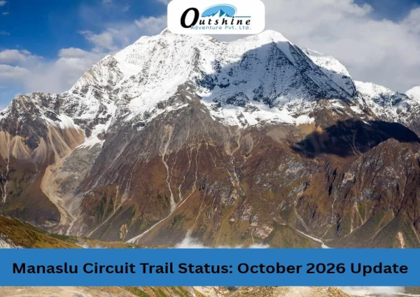
Mount Manaslu itself, 8,163 meters, was first climbed on May 9, 1956, by Japanese climber Toshio Imanishi and Sherpa Gyalzen Norbu, the same Gyalzen Norbu who, remarkably, had summited Makalu just a year earlier, making him the first person to climb two 8,000 meter peaks. The mountain has carried a strong Japanese connection ever since. There's a saying among Himalayan guides that "just as the British consider Everest their mountain, Manaslu has always been a Japanese mountain." None of that history is required reading before you go, but it's the kind of detail that makes the trail feel less like scenery and more like something with real weight behind it.
The trek itself runs roughly 177 kilometers, following the old salt trading route along the Budhi Gandaki river before climbing over Larkya La Pass at 5,106 meters and dropping into the Annapurna region on the other side. Along the way you pass through views of at least ten peaks over 6,500 meters, several of them well over 7,000. If you're weighing this against the more commercial routes, here's the honest pitch. Fewer people, more unfiltered culture, and a mountain that most Western trekkers couldn't pick out of a lineup, which, frankly, is part of the appeal.
If you're still torn between routes first, our Manaslu Circuit vs Annapurna Circuit comparison breaks down the trade-offs in more detail, and how it stacks up against the region's other benchmark route is covered in our Everest Base Camp Trek package. You can also browse the full Manaslu Trekking collection for related routes in the region.
Quick Trek Overview- Manaslu Circuit Trek
| Detail | Information |
|---|---|
| Trek duration | 17 days (Kathmandu to Kathmandu, including arrival, sightseeing, and departure days) |
| Trail distance | Approx. 177 km |
| Maximum altitude | Larkya La Pass, 5,106 m |
| Mt. Manaslu elevation | 8,163 m (8th highest mountain in the world) |
| Trek difficulty | Strenuous |
| Best seasons | March to May (spring), late September to November (autumn) |
| Permits required | MRAP, MCAP, ACAP, plus a local Tsum Nubri Rural Municipality fee |
| Guide requirement | Mandatory (licensed guide, registered agency) |
| Minimum group size | 2 trekkers (for restricted area permit) |
| Trek opened to foreigners | 1991 |
| Start / end points | Kathmandu, via Machha Khola, looping back through Dharapani and Besisahar |
| Route type | Teahouse trek (no camping required) |
Manaslu Circuit Trek Difficulty: What You're Actually Signing Up For
Trekking agencies love the word "moderate." I'd push back on that for Manaslu. This is a strenuous trek by most reasonable standards, and it's worth being clear eyed about why before you commit weeks of planning to it.
What makes it hard:
- Consecutive long walking days, several stretches of 7 to 9 hours on foot
- A single high altitude pass crossing at 5,106 m, done in one long push starting well before dawn
- Rapid altitude gain in the second half of the trek, with several nights spent above 3,500 m in a row
- Rough, variable terrain including suspension bridges, landslide prone riverbanks, and loose scree near the pass
- Limited rescue infrastructure compared to Everest or Annapurna, so help can be hours away
- Cold exposure on summit day, often starting the walk around 3 am in sub zero temperatures
What makes it manageable:
- No technical climbing, ropes, or crampons required, though trekking poles and microspikes are strongly recommended for the pass
- Teahouse lodging the entire way, so no camping gear is needed
- Well marked trail with checkpoints and established acclimatization stops
- A mandatory guide who knows the route, the weather patterns, and the early signs of altitude sickness
A few numbers worth knowing: most days before the pass cover roughly 9 to 11 km, while the descent days after Larkya La can stretch past 15 to 20 km in a single push. Daily walking time generally runs 6 to 9 hours depending on terrain, weather, and how your body is handling the altitude.
Bottom line, you don't need to be a mountaineer, but you do need solid cardiovascular fitness, multi day hiking experience, and a genuine willingness to slow down and acclimatize rather than push through symptoms. Altitude has ended more Manaslu treks than bad knees ever have.
For the full day-by-day breakdown, including accommodation, meals, and elevation for each stop, see the complete Manaslu Circuit Trek itinerary
Along the Trail: What to Expect at Each Stop and the Villages Between Them
Machha Khola (890 m)
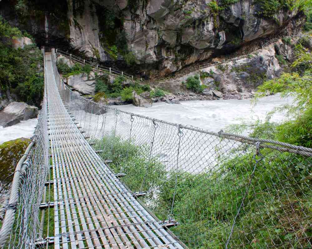
Machha Khola sits right at the mouth of the Budhi Gandaki gorge, and it's the first place on the trek where the landscape actually starts to feel remote, even though you're technically still only a day's drive from Kathmandu. The setting is low, warm, and green: terraced rice paddies climb the hillsides, water buffalo graze near the riverbank, and the Budhi Gandaki itself, a fast, silty, glacier fed river, is a constant presence on the walk in. The village takes its name from the Nepali word for fish, a small nod to the river that shapes everything about how this stretch of the valley lives and farms.
Culturally, this is still very much a Hindu farming region, closer in character to the Nepali midhills than to the Tibetan Buddhist villages waiting further up the valley. Ethnically it's a mix of Gurung, Magar, and Brahmin-Chhetri communities, and the architecture, houses, terraces, and small roadside shops, reflects that. From a practical standpoint, Machha Khola matters less for what it offers and more for what it represents: it's your body's first real test of heat, humidity, and multi hour walking after the drive out from Kathmandu, and a useful gauge for how your boots, pack, and pace are settling in before the trail climbs into thinner, colder air. Teahouses here are simple, reliable, and cheap by the standards of what's coming later in the trek.
Jagat (1,340 m)
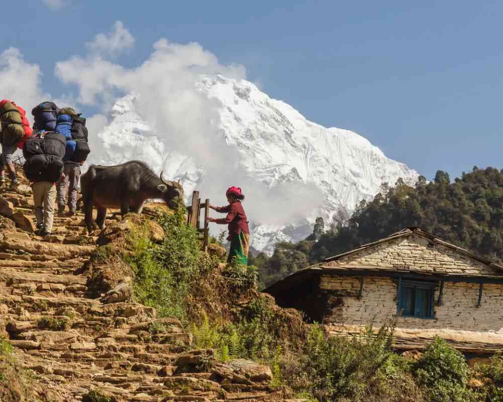
Jagat carries real historical weight. For centuries, this village sat directly on the old salt and grain trading route that connected the Tibetan plateau to the lowlands of Nepal and India, and that trading post identity is still visible in the architecture: tightly packed stone houses, slate roofs, and stone paved streets built to handle foot and mule traffic rather than modern tourism. It's a genuinely attractive village on its own merits, one of the more photogenic stops on the lower trail, well before the high mountain scenery even begins.
Functionally, Jagat is where the trek stops feeling like a warm up and starts feeling official. This is the first major checkpoint where officials verify your restricted area permit, conservation area permits, and passport details, and it's also where the local Tsum Nubri Rural Municipality fee gets collected. Agencies report that Jagat is where incomplete or improperly processed paperwork gets caught more than anywhere else on the route, so it's worth having everything organized before you arrive rather than sorting it out at the checkpoint. Beyond the bureaucracy, Jagat is also a natural mental marker: from here, the valley genuinely narrows, the crowds thin out, and the sense of entering a controlled, less visited region starts to sink in.
Deng (1,804 m)
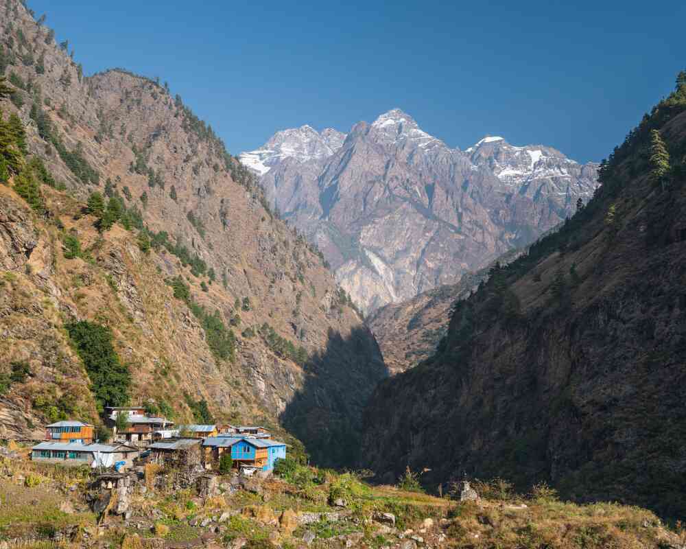
Deng is where the trek's cultural center of gravity shifts, not gradually but fairly abruptly. Up to this point you've been walking through a Hindu-influenced farming valley; from Deng onward, the villages, architecture, and daily rhythms carry strong Tibetan Buddhist influence, a preview of everything waiting in Nubri and Tsum. Mani walls, low stone walls carved with sacred inscriptions and often painted, start appearing regularly along the trail, along with chortens and increasingly elaborate prayer flag displays. Local custom asks that you always pass these structures on the left, keeping them on your right shoulder as you walk, and most guides will point this out the first time you approach one.
Geographically, the gorge narrows sharply around Deng, with waterfalls visible on the cliffs across the river and the trail turning rockier, narrower, and more exposed in places, a small taste of the terrain that becomes standard higher up. Deng itself is a small, quiet settlement with limited teahouse options, but its real significance isn't in size, it's in being the hinge point where the trek's cultural character properly changes.
Namrung (2,660 m)
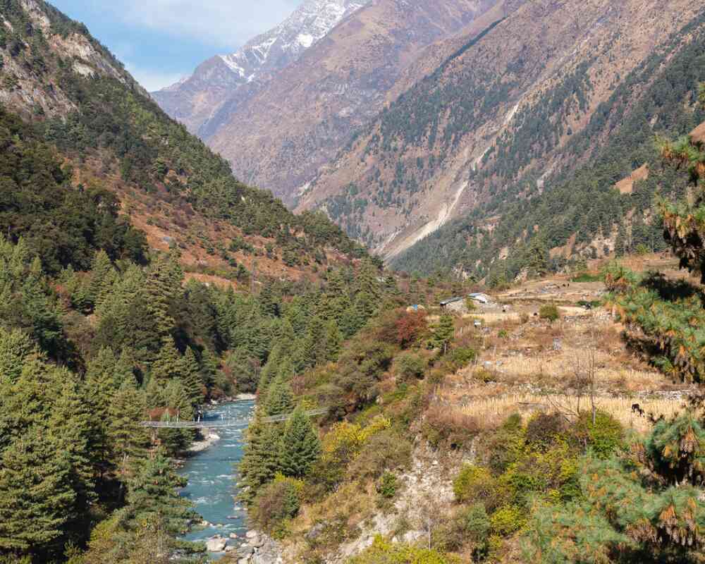
Namrung functions as both a checkpoint and a genuine elevation threshold, which makes it one of the more logistically important stops on the lower half of the trek. A second permit check happens here, generally more thorough than Jagat's, and the village has some of the better equipped teahouses on this stretch of the route, a small but appreciated upgrade after several days of very basic lodging.
Ecologically, Namrung marks the point where the valley stops feeling subtropical and starts feeling genuinely Himalayan. Pine and juniper forest begin replacing the denser, broadleaf vegetation of the lower gorge, the air noticeably cools, and on clear days you get your first unobstructed views of Ganesh Himal, Himalchuli, and Manaslu itself rising above the treeline. For many trekkers, this is the moment the trip stops feeling like a long walk through a river valley and starts feeling like an actual Himalayan expedition. It's also a sensible place to slow your pace slightly, since the climbing gets steadily more serious from here on.
Lho and Shyala (around 3,500 m)
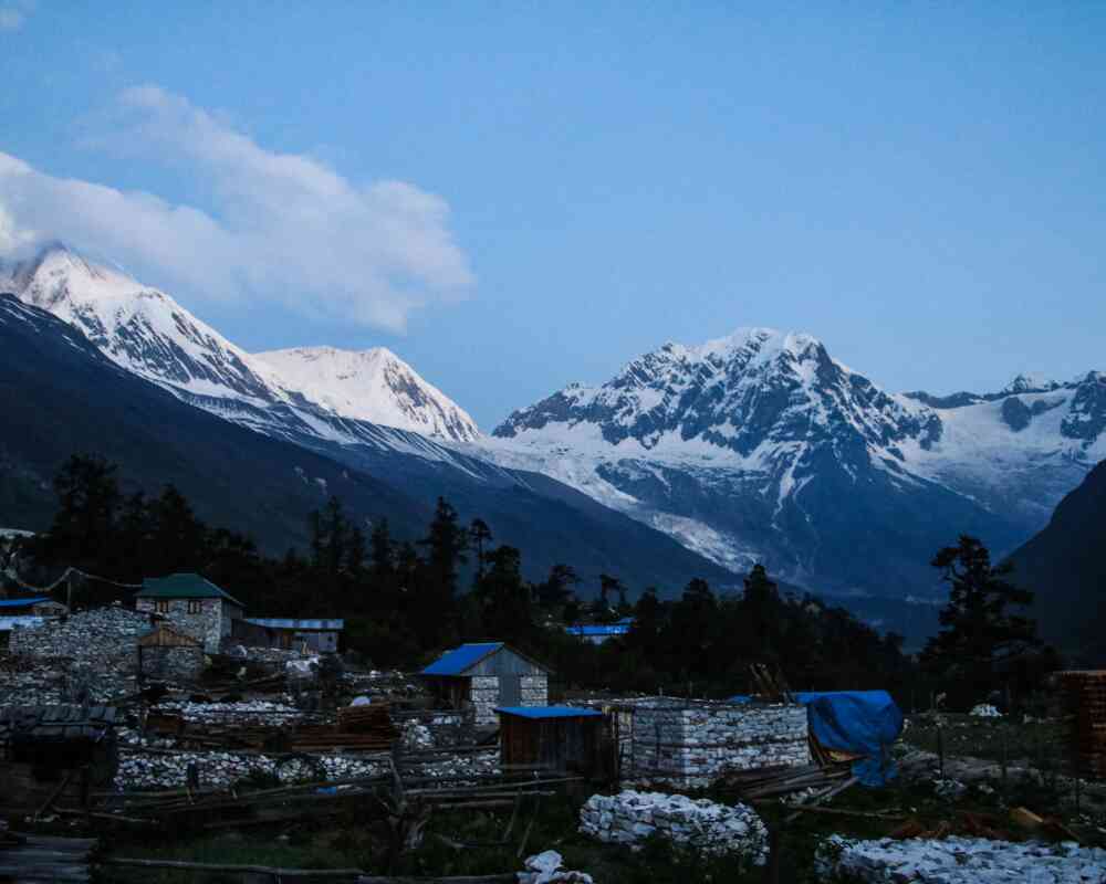
Lho and Shyala sit close together at a similar elevation, and depending on the operator and the day's conditions, itineraries route through one or the other, sometimes both. Lho is the larger and better known of the two, home to one of the region's largest monasteries and, on a clear morning, one of the single best close range views of Manaslu on the entire trek. The mountain feels almost directly overhead from certain points in the village, close enough that it stops being a distant backdrop and starts being the actual, physical reason you're here.
Shyala is smaller and quieter, with an equally striking outlook onto the Manaslu massif but noticeably less foot traffic, making it an appealing alternative for trekkers who want a slightly more contemplative overnight stop. Both villages are draped in prayer flags and chortens, and both sit at the point where the trail properly transitions from forested valley to open, high mountain terrain. Culturally, this is deep Nubri territory: Tibetan Buddhist, yak herding, and increasingly shaped by the rhythms of high altitude agriculture rather than the rice terrace farming seen lower down.
Sama Gaon (3,585 m)
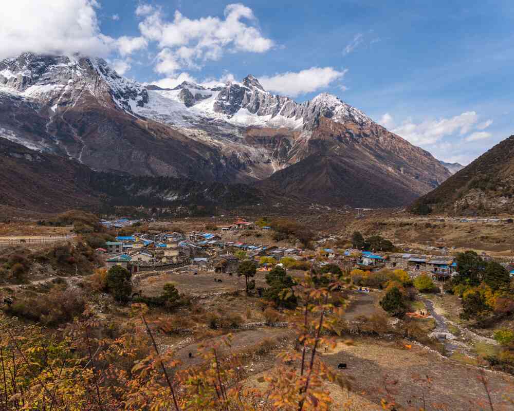
Sama Gaon, sometimes spelled Samagaon, is arguably the single most important stop on the entire circuit, not because of any one landmark but because of everything it represents at once: cultural anchor, acclimatization base, and the first place where Manaslu's true scale becomes impossible to ignore. The village has a strong, unmistakably Tibetan character: flat roofed stone houses built to withstand wind and cold, yak herds grazing on the surrounding slopes, and a monastery that has functioned as a genuine center of community and spiritual life for generations, not a site dressed up for visitors.
From a trekking standpoint, Sama Gaon is where the itinerary builds in its most important acclimatization day, typically used for a demanding side trip toward Manaslu Base Camp at around 4,800 meters, often passing the glacial Birendra Lake along the way. That side hike does double duty: it gives your body real altitude exposure to adapt to before the pass, and it delivers some of the best photography of the entire trip. It's also the same base camp used by climbers on the full Manaslu Expedition, so don't be surprised if you cross paths with a summit team gearing up while you're there. Many trekkers say this is the point where the trip's difficulty and its reward both become fully real at the same time, the mountain dominating the skyline in a way no photograph quite prepares you for, and the altitude reminding you, with every slightly heavier breath, exactly what you signed up for.
Samdo (3,860 m)
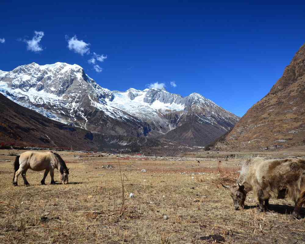
Samdo is the last significant village before Larkya La, and everything about it reflects that frontier position. Sparse, windswept, and close enough to the Tibetan border that the village has historically functioned as a genuine trading outpost, Samdo has an atmosphere that's hard to find anywhere else on the trek, right down to the small shops stocking goods that have clearly crossed the border rather than come up from Kathmandu. The landscape here turns properly alpine: open, rocky, thin on vegetation, with wind as a near constant companion rather than an occasional inconvenience.
Samdo is also a scheduled acclimatization stop, and unlike some of the earlier rest days, this one carries real weight given how close you now are to the pass. Most itineraries use it for an optional hike toward the Tibetan border ridge or up to the Samdo Peak viewpoint, both of which offer sweeping views back down the valley you've spent nearly two weeks climbing through. Skipping this acclimatization day, or treating it as optional in practice rather than name, is one of the more common reasons trekkers struggle on the pass two days later. Our High Altitude Sickness guide covers exactly what to watch for at this stage.
Dharamsala or Larkya Phedi (4,460 m)
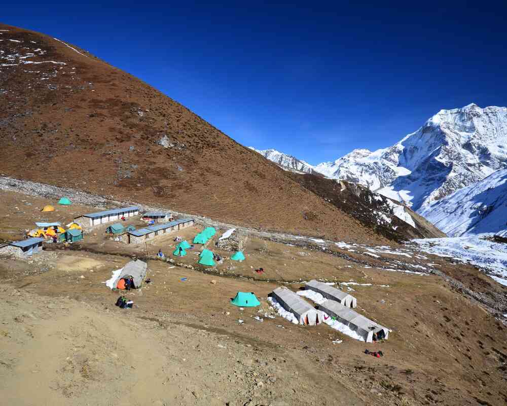
Dharamsala, also called Larkya Phedi, isn't really a village in any conventional sense. It's a small cluster of basic lodges that exist for exactly one purpose: staging trekkers for the pass crossing the next morning. There's no real community here, no monastery, no market, just simple shelter at a serious altitude. Facilities are minimal and the cold is genuinely serious, even inside the lodges, which tend to be thin walled and hard to heat.
What Dharamsala lacks in charm it makes up for in function. Breaking the climb from Samdo into two stages, rather than attempting one enormous push straight to the pass, is what makes the crossing manageable for most trekkers. Most people eat an early dinner, hydrate as much as they can stomach, and try to get some sleep knowing they'll be up again well before 3 am. It's not a place anyone lingers by choice, but its role in the itinerary is genuinely important.
Larkya La Pass (5,106 m)
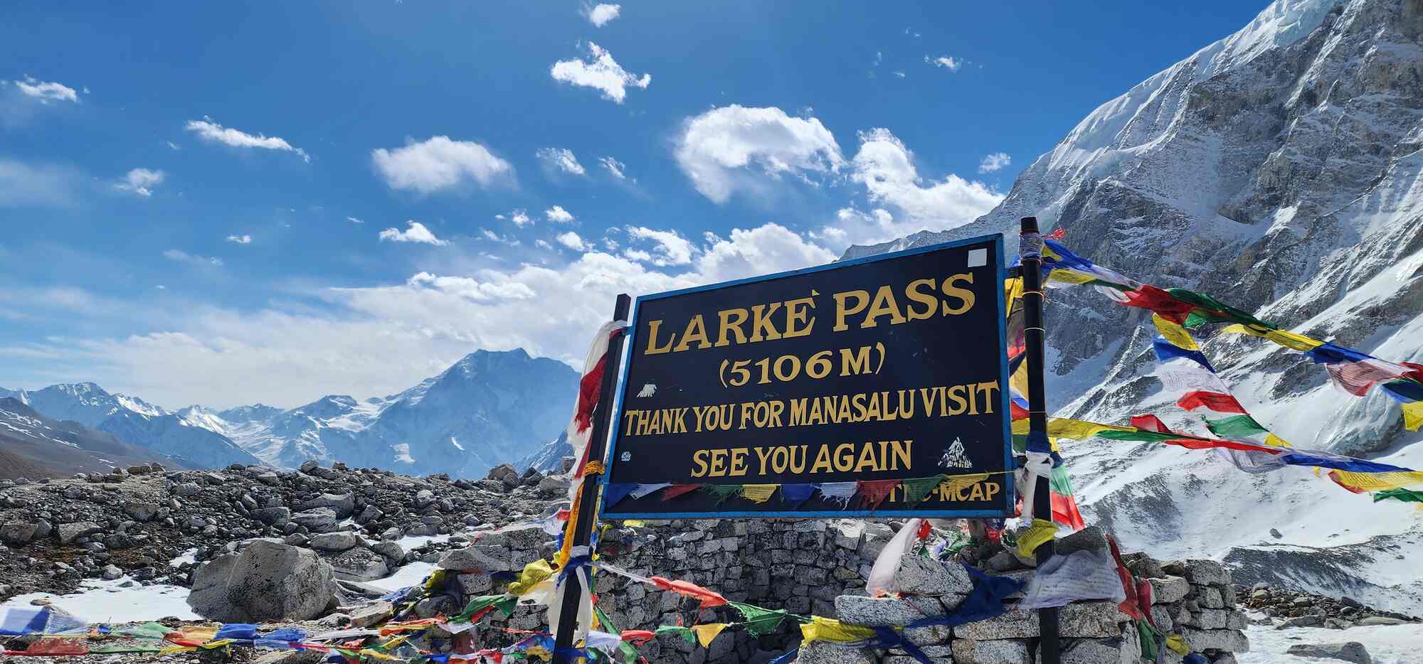
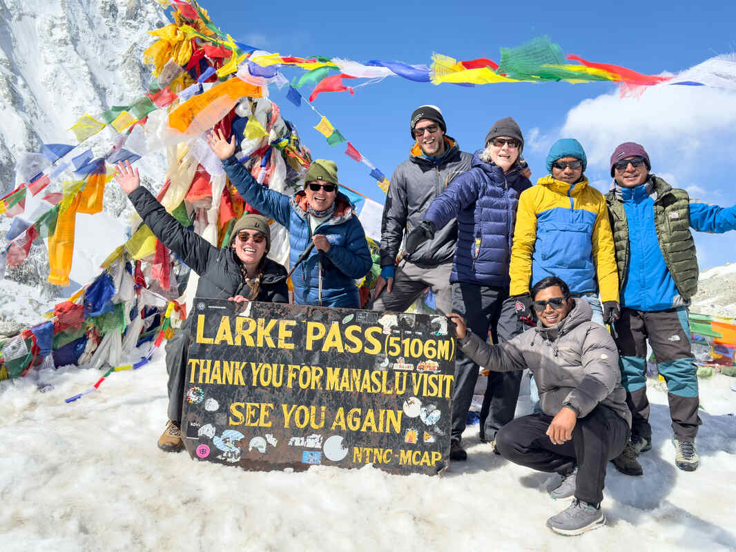
Larkya La is the trek's high point in every sense, geographically, physically, and emotionally. The crossing typically starts in full darkness, often on frozen ground, with temperatures well below freezing and thin, biting wind cutting across completely open terrain. The first couple of hours pass by headlamp over steep, rocky moraine, slow and repetitive in a way that tests patience as much as fitness. Then, gradually, the sky lightens, and peaks begin appearing one after another: Manaslu, Himalchuli, Peak 29, Larkya Peak, and Bouddha Himal, each catching the first light in turn.
At the summit, prayer flags mark the highest point, snapping constantly in a wind that rarely lets up. Nobody lingers here for long, the cold and thin air see to that, but almost everyone who's crossed it describes the same thing: a mix of exhaustion, relief, and genuine awe that's hard to replicate anywhere else on the trek. It's also, practically speaking, the point of no easy return, since the descent on the far side is long and there's no shortcut back.
Bhimthang (3,790 m)
The descent from Larkya La drops trekkers into Bhimthang, and the change in scenery is almost disorienting after two weeks in a tight river gorge and then a barren, high altitude pass. Bhimthang is a wide, open glacial valley, ringed by peaks, with genuinely spectacular views of Manaslu's south face, a completely different angle on the mountain than anything seen from Sama Gaon or Lho. Many trekkers rate the views here as highly as the views from the pass itself, partly because you finally have the oxygen, warmth, and mental space to actually take them in, rather than simply surviving the cold and pushing forward.
Bhimthang also marks a psychological shift in the trip. The hardest single day is now behind you, and everything from here is, relatively speaking, downhill, both literally and in terms of difficulty. It's a good place to slow down for an evening and actually process what the crossing meant, before the final descent days begin.
Gho (2,515 m)
Gho rarely gets much attention in trekking accounts, and that's largely fair, it's a modest, low key stopover rather than a destination in its own right. But it plays a genuinely useful role in the itinerary. The descent from Bhimthang, through rhododendron, pine, and oak forest, is long and hard on the knees, and breaking it into two days rather than pushing straight to Dharapani gives your legs a real chance to recover after the pounding of the pass descent. The village itself is quiet, forested, and a noticeable contrast to the open alpine terrain of the previous few days, a gentle reintroduction to lower altitude greenery before the trek's final stretch.
Dharapani (1,920 m)
Dharapani marks the point where the Manaslu Circuit formally merges with the Annapurna Circuit trail, and the change is immediate and hard to miss. After close to two weeks of relatively quiet trails, minimal infrastructure, and small, tightly knit communities, Dharapani suddenly brings more trekkers, more teahouse choices, and a noticeably more developed feel. It's not a highlight in the way Sama Gaon or Larkya La are; it's a transitional, practical stop. But it carries real significance as the place where the wilder, more remote half of the journey gives way to the final road stretch back toward civilization, and where you get a first real sense of just how quiet the trail behind you has actually been. If this merge point has you curious about the trail on the other side, our Annapurna Circuit Trek package picks up more or less where Manaslu leaves off.
The Smaller Villages In Between
The named stops above are where you'll actually sleep most nights, but the trek isn't a series of jumps between them. It's a continuous walk through dozens of smaller settlements, and a handful are worth knowing about even if you only pass through for a tea break.
Tatopani, between Machha Khola and Jagat, is best known for the natural hot spring right beside the trail, a genuinely welcome stop for sore feet on only your second or third day of walking. Philim, just before Deng, is a sizeable Gurung village surrounded by barley and wheat terraces, and it's often where trekkers first sense the trail tilting upward in earnest after several days of relatively flat riverside walking. Ghap and Prok, tucked between Deng and Namrung, sit in a narrower stretch of the gorge where forest presses close to the trail on both sides, and they mark the last real pocket of dense woodland before the valley opens up higher up. Lokpa, close to Deng, is the junction point where the Tsum Valley trail branches off from the main Manaslu Circuit, so it's a useful mental landmark even if you're not taking the detour. Further up, near Samdo, Larke Bazaar is less a village than a seasonal trading spot marked by mani walls and prayer flags, a quiet reminder of the cross-border trade that shaped this entire valley long before trekking permits existed.
None of these places will anchor your itinerary the way Sama Gaon or Bhimthang will, but they're part of what makes the walking days feel varied rather than repetitive, and they're where a lot of the small, unplanned moments of the trek actually happen.
Tsum Valley: Worth the Detour?
If your schedule has flexibility, the Tsum Valley extension is worth serious consideration. It branches off the main trail near Lokpa and typically adds five to seven days to your trip.
Why trekkers add it:
- Tsum Valley only opened to foreign trekkers in 2008, making it one of the more recently accessible regions in Nepal
- It's a deeply Buddhist side valley with monasteries at Mu Gompa and Rachen Gompa that see very little tourist traffic
- The cultural experience is arguably even more immersive than the main Manaslu route
- It requires its own separate permit, processed alongside your main Manaslu permits
If isolation and cultural depth are the main reasons you're drawn to Manaslu in the first place, Tsum Valley pushes that even further, at the cost of a longer, more demanding overall itinerary. You can see the full route and pricing on our Tsum Valley Trek (Manaslu) package page if you'd like to compare it against the standard circuit. Trekkers with mountaineering ambitions beyond the circuit sometimes also look at the full Manaslu Expedition, which continues past base camp toward the summit itself, though that's a very different undertaking from the trek covered here.
Practical Tips for the Manaslu Circuit Trek
Permits: what you need and how it works
| Permit | Purpose | Approx. Cost |
|---|---|---|
| Manaslu Restricted Area Permit (MRAP) | Required for the controlled zone between Jagat and Dharapani | $100 for first 7 days (autumn) plus $15/day after; $75 plus $10/day (off season) |
| Manaslu Conservation Area Permit (MCAP) | Covers the protected area around the Manaslu massif | Around $30 per person, year round |
| Annapurna Conservation Area Permit (ACAP) | Required because the trail exits into Annapurna territory after Dharapani | Around $30 per person, year round |
| Tsum Nubri Rural Municipality Fee | A local fee collected at Jagat | Around Rs 1,000 per person |
| Tsum Valley RAP (optional) | Required only if extending into Tsum Valley | Around $40 per person, flat rate |
A few things worth knowing about the permit process:
- None of these can be arranged independently online. A government registered trekking agency must process your MRAP, and it has to name your licensed guide in the application.
- MCAP and ACAP can technically be arranged separately, but most trekkers let their agency handle all permits together, since MRAP cannot be issued without them.
- Build in at least two full working days in Kathmandu before departure. Permits aren't issued on weekends or public holidays, and rushing this step is a common cause of delayed starts.
- Since March 2026, Nepal's Department of Immigration removed the long standing rule requiring two trekkers to share a single restricted area permit, so solo travelers can now obtain their own MRAP, though a licensed guide is still required either way.
Best time for the Manaslu trek
| Season | Months | Conditions |
|---|---|---|
| Spring | March to May | Daytime temperatures around 15 to 20°C lower down, dropping to minus 5 to minus 10°C near the pass. Rhododendron blooms lower down, generally stable weather |
| Autumn | Late September to November | The busiest and most reliable season. Clear post monsoon skies, daytime temperatures 18 to 22°C lower down, minus 8 to minus 12°C near the pass, and overlaps with the Dashain and Tihar festivals |
| Winter | December to February | Possible for experienced, well equipped trekkers, though temperatures drop well below freezing at altitude and heavy snow can close Larkya La entirely |
| Monsoon | June to August | Frequent rainfall, leeches, landslide risk along the Budhi Gandaki valley, and poor visibility, generally best avoided |
Guide and porter requirement
A licensed guide is legally mandatory on Manaslu. There's no version of this trek where you walk it unguided. Beyond the legal requirement, a good local guide reads weather patterns, altitude symptoms, and trail conditions far better than any guidebook can. Hiring a porter is optional but genuinely worth it, since the Larkya La day is long and cold enough without carrying a full pack over it. You can get a sense of the people who'd actually be leading you on our team page.
- Walk at a steady, unhurried pace, especially above 3,500 m
- Hydrate more than feels necessary, since altitude dehydrates you faster than you'd expect
- Use the built in acclimatization days at Sama Gaon and Samdo, and don't skip them to save time
- Learn the early warning signs of acute mountain sickness, including headache, nausea, loss of appetite, and disturbed sleep
- Treat early symptoms as a signal to stop ascending or descend, not to push through
- Talk to a doctor about Diamox before you leave home, not on the trail
For a fuller rundown of symptoms, prevention, and what to do if things escalate, see our dedicated High Altitude Sickness guide.
Packing essentials
| Category | Key Items |
|---|---|
| Layering | Base layers, insulating mid layer, down jacket, waterproof and windproof shell |
| Sleep system | Four season sleeping bag rated to at least minus 15°C |
| Footwear | Broken in trekking boots, camp shoes, wool hiking socks |
| Gear | Trekking poles, microspikes for the pass, headlamp with spare batteries, dry bags |
| Health | Sun protection (high altitude UV is intense), water purification, personal first aid kit, Diamox if prescribed |
| Extras | Power bank, printed permit copies, cash in small denominations (no ATMs past Machha Khola) |
Teahouses
Lodging is teahouse style the entire route, so no camping gear is required. Rooms are basic, twin beds, thin walls, and shared bathrooms that become the norm above Namrung. Hot showers are available lower down but get rarer and more expensive as you climb, and by Samdo and Dharamsala, don't expect much beyond a bucket of hot water. Meals lean heavily on dal bhat, noodle soups, and Tibetan bread, with menu variety shrinking noticeably above Sama Gaon.
Manaslu Circuit Trek Cost: What to Budget
Costs vary with group size, season, and comfort level, but here's a realistic breakdown for a standard 17 day trek that includes the Kathmandu sightseeing and preparation days.
| Item | Approximate Cost (USD) |
|---|---|
| MRAP (autumn, approx. 2 weeks) | $190 to $210 per person |
| MRAP (off season, approx. 2 weeks) | $135 to $155 per person |
| MCAP | $30 per person |
| ACAP | $30 per person |
| Licensed guide (per day) | $25 to $35 |
| Porter (per trip, optional) | $250 to $300 total |
| Teahouse lodging plus meals (per day) | $25 to $35 |
| Ground transport (Kathmandu to Machha Khola, Dharapani/Besisahar to Kathmandu) | $60 to $220 total, depending on shared jeep or private vehicle |
| Kathmandu hotel and guided city tour | Often bundled into full packages |
| Travel insurance (with high altitude rescue cover) | $50 to $100 |
Group bookings tend to bring the per person price down noticeably. As a rough real world reference, full package pricing for a 17 day Manaslu Circuit Trek with permits, guide, accommodation, and airport transfers included commonly runs somewhere in the range of $830 to $1,000 per person for groups of two or more, with larger groups landing at the lower end of that range. Independent trekkers piecing together permits, guide, and lodging separately typically land closer to $1,200 to $2,800 for the full trip, depending on season and how much of the planning they outsource to an agency versus arranging themselves.
You can see exactly what's included at each group size on the Manaslu Circuit Trek cost details page, and if you're weighing this route against a nearby alternative, the Annapurna Circuit Trek package is a useful side by side reference point.
Frequently Asked Questions
How hard is the Manaslu Circuit Trek? It's rated strenuous. Expect consecutive long walking days, one high altitude pass crossing at 5,106 m, and real altitude exposure above Sama Gaon. Prior multi day hiking experience and solid cardiovascular fitness matter more than technical climbing skill, which isn't required.
What are the main villages on the Manaslu Circuit Trek? Working roughly low to high, the main overnight stops are Machha Khola, Jagat, Deng, Namrung, Lho, Shyala, Sama Gaon, Samdo, Dharamsala (Larkya Phedi), Bhimthang, Gho, and Dharapani. Each one marks a real shift in the trail, from Hindu farming country low in the gorge to Tibetan Buddhist villages higher up.
Which village has the best view of Manaslu? Sama Gaon and Lho are usually singled out as the two best viewpoints, with Lho offering one of the closest, most direct views of the mountain anywhere on the trek. Bhimthang, on the descent side of Larkya La, shows an entirely different angle, the south face, which many trekkers rate just as highly.
Where does the trek's character change from Hindu to Buddhist villages? Around Deng. Everything below it, Machha Khola, Jagat, feels like the Nepali midhills. From Deng onward, mani walls, chortens, and prayer flags start appearing regularly, and by Lho and Sama Gaon the villages are unmistakably Tibetan Buddhist in character.
Is Tsum Valley worth adding to the main route? If you have the extra five to seven days, yes. It branches off near Lokpa and reaches monasteries at Mu Gompa and Rachen Gompa that see very little outside traffic, arguably even more immersive than the main Manaslu villages. Details are on the Tsum Valley Trek (Manaslu) package page.
Which stop should I treat most seriously for acclimatization? Sama Gaon and Samdo both carry scheduled rest days, and neither should be skipped or shortened. Sama Gaon's side trip toward Manaslu Base Camp and Samdo's proximity to the pass make these the two places where rushing tends to catch up with people two or three days later.
Do I need a permit to visit these villages? Yes. The Manaslu Restricted Area Permit (MRAP) covers the controlled zone between Jagat and Dharapani, alongside the MCAP and ACAP conservation permits and a local fee collected at Jagat. None of it can be arranged independently; a registered trekking agency has to process it with your licensed guide named on the application.
Final Thoughts
The Manaslu Circuit isn't a trek you decide on lightly, and it shouldn't be. It takes two full working days in Kathmandu just to sort permits, a licensed guide from a registered agency for the entire route, and a minimum of 17 days set aside before you've even reached Larkya La. What you get for that is a trail with far fewer people on it than Everest or Annapurna, villages that still function on their own terms rather than around tourism, and a pass crossing that most trekkers rank among the hardest single days of their trekking lives. Weigh that honestly against your fitness, your schedule, and how much acclimatization time you're actually willing to protect, and the trek either makes sense for you or it doesn't. If it does, book with enough runway to get the permits right and to not skip the rest days.
This guide draws on years of actually running the route, including the perspective of Som Kusum Majhi, a trekking guide at Outshine Adventure who started his career as a porter and has since covered nearly every major trekking region in Nepal, including Annapurna, Everest, Langtang, Manaslu, and Upper Mustang, along with guiding work in Tibet and India. That range is what makes his read on Manaslu useful: he's not describing it in isolation, he's describing it against the other circuits he leads. For a closer look at what actually makes this trek hard, in his own words, see his guide's perspective on Manaslu Circuit Trek difficulty. His standing advice is simple, respect the acclimatization days, since that's almost always where a trek goes right or wrong.
Ready to talk it through with someone who's actually run this route? Send an inquiry, meet Som and the rest of the team on our team page.
- Tsum Valley Trek (Manaslu), a 12-day extension into an even more remote, deeply Buddhist side valley
- Manaslu Expedition, for climbers who want to go beyond base camp toward the summit
- Annapurna Circuit Trek, Nepal's other classic circuit route, for comparison
- Everest Base Camp Trek, the benchmark trek most people measure everything else against
- Manaslu Circuit vs Annapurna Circuit, if you're still choosing between the two
.webp)